STATUS: 19 Mar 2017

STATUS: IOP WATCH

We continue to watch the event taking shape for the time period of 24-26 Mar.

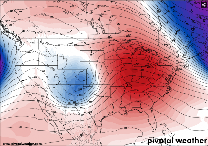
This wave is just a minor feature about 1000 mi west of the California coast this morning.  And so how it takes shape depends a lot on the details of the flow in the jet that is beginning to interact with this wave.  It will be a day or two until the system advances into the denser observing network on the North American continent.

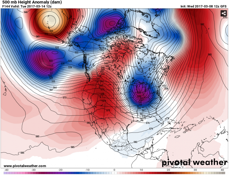
The models generally agree that a significant wave will pass through northern AL between Friday evening and Saturday night.  The devil is in the details.  The timing of the passage will make a big difference on how much CAPE builds up with daytime heating.  The intensity in the southern portion of the wave, in the lower Mississippi Valley, will make a big difference on the low-level flow, which impacts the rate at which moisture returns in low levels and CAPE develops, as well as the intensity and direction of the shear in the lowest 3000 ft or so.  That in turn affects tornado potential.  And all of these details factor into the mode of the storms… supercells, Quasi-Linear Convective Systems (“QLCS”… or squall lines), or something different.

For the NOAA P-3 aircraft, the questions are even bigger.  Because the aircraft can roam all across the Southeast, it can potentially observe an event too far west for the ground-based researchers, land and rest the crew, and then observe an event over Alabama.  And if the system is slow enough, potentially another round of observations further east the next day.

So the researchers continue to watch the forecast evolve, and think about how soon they need to be in Alabama, what kind of deployment strategies might work best, etc.  And with this system there is an additional logistical issue to think about: another wave is following right behind the first one, and may give us a second observing opportunity about 3 days later.  So we will have to pay attention to this second system and decide whether to end the IOP (if there is one) around Saturday night/Sunday, or stay in Alabama for another observing chance toward Tuesday or Wednesday.

Never simple.  Never clear.

Tags: None

STATUS: 18 Mar 2017

STATUS: IOP WATCH (new)

In the midday conference call today, the VORTEX-SE researchers decided to not conduct observations on Tue 21 Mar, but are now watching a likely IOP opportunity toward next weekend.  (If you haven’t been following these messages, “IOP” stands for “Intensive Observing Period”… that’s when the researchers hit the field with all their observing equipment.)

The Tuesday forecast illustrates one of the many challenges the researchers face.  Most of the VORTEX-SE researchers travel to Alabama to conduct observations because staying there for two months or more would consume resources better spent on the science.  The funds support about four IOPs.  And so they have to weigh the likelihood that an event will provide enough data to generate some new knowledge, and whether there will be better opportunities as March and April go on.

So on Tuesday, there will be enough CAPE around to support thunderstorms, if they were initiated.  (CAPE is “Convective Available Potential Energy” which measures how much updraft air will be accelerated because of the difference between the updraft temperature and the temperature outside the updraft.)  But, because of an upper ridge, the winds will be fairly weak through the whole depth of the atmosphere.  One can never rule out tornadoes completely, but given our current understanding of tornadic storms and the environmental conditions that support them, this looks like an extremely-low probability day.  If we had unlimited resources and could observe 24/7 for a number of months, we could probably catch one or two surprising events… and there’s probably a lot to be learned from them when they happen.  But we have to spend the research funds in a way that can give us the most new knowledge for the buck.

Looking ahead, we see another challenge.  The forecast models are pretty adamant that a strong wave and associated cold front will move through the Southeast toward this weekend.  Right now, the major models are in very poor agreement about the timing of this, and individual models are in poor agreement with themselves from one model run to the next.  It looks like an IOP is quite likely for this system, and it will be up to the researchers and their forecast team at the University of Alabama-Huntsville and NWS-Huntsville to try to get a good enough picture of the timing so that the researchers can assemble in Huntsville and plan the details of their deployment.  Stay tuned…

Tags: None

STATUS: 17 Mar 2017

STATUS: IOP WATCH

The outlook for the activity around the 21st of March continues to be unfavorable, and at this time, it appears an IOP is extremely unlikely.  While it appears that low-level heat and humidity will be sufficient for some thunderstorms, the winds aloft will have weakened so much that there should be very little tornado potential.  Around midday tomorrow, the researchers are likely to officially, finally, “pull the plug” on this IOP.

However, we expect that by tomorrow, details will start to come into a bit more focus regarding the large pattern change that is expected to occur over the US next week.  This pattern change is fairly likely to bring opportunities for IOPs to the Southeast US over the next couple of weeks.  The first period we are watching closely will be around Friday or Saturday (24-25 Mar).  There are a lot of things that could “go wrong” from the perspective of the VORTEX-SE researchers, so it’s way too early to declare an IOP.  But, we will begin watching this possibility tomorrow, and so we will probably again be in an “IOP Watch” for that later period.  Compare this forecast to the one posted up-thread:

Notice how this forecast for the mid-troposphere for late next week has flipped from an eastern trough-western ridge pattern, to the opposite.  This allows stronger southwest flow aloft to develop, and below that should be some fairly strong southerly flow bringing humidity off of the Gulf of Mexico.  As this first trough advances toward Alabama, one would expect a fairly strong surface system to eventually pass through the state.

Some of us will be traveling to Alabama next week to get together with the media at the HSV airport on Tuesday and try to convey all the unique, difficult, and exciting challenges this program faces.  So these blog postings may be hit-and-miss for the next few days.

Tags: None

STATUS: 16 Mar 2017

STATUS: IOP Watch

The VORTEX-SE researchers are watching the pattern change that has been forecast by the ensembles of global models for the past week or so.  This will be a change from the deep trough in the NE US (and the associated wintery weather there) and strong ridge in the western US.  The new pattern is likely to be one of a trough in the west, with waves moving through the flow and possibly affecting the VORTEX-SE domain.  There should be a big uptick in the strength of the upper flow as well, so supercells will become a greater concern as time goes on.

The first opportunity for observations may be on Tue 21 Mar.  This is another very difficult forecast problem, because the teams would like to make a decision on this event tomorrow (Fri 17 Mar).  If they could make that decision, they could take care of travel arrangements during the afternoon, and get to Alabama on Sunday or Monday.  If the decision isn’t clear until Saturday, then travel arrangements become much more difficult.  Right now, it looks like there may be CAPE (buoyant thermal energy to drive the updrafts) but it’s very unlikely that the atmospheric flow structure would support supercells.  So now we have to ask ourselves whether we think the flow, and the vertical shear of that flow, will be strong enough near the ground to support tornadoes from non-supercell storms.

So far in VORTEX-SE, we rarely have had an obvious “go” decision.  This is partly because during the 2016 campaign, and so far in 2017, there haven’t been any of the strong systems that are normally associated with tornadic weather.  It’s also because of the uncertainty that is always present 3-5 days before an event.

Tue 21 Mar is “Media Day” in Huntsville, when the media will have a chance to look at a lot of our instruments and interview us about the science issues surrounding the tornado problems of the Southeast US.

Tags: None

STATUS: 13 Mar 2017

STATUS: Down

The pattern of a ridge in the west and a trough in the east continues today, with a major winter weather event in store for the Northeast.  This pattern is associated with cool, stable weather in Alabama, so VORTEX-SE is still down.

However, we still see signs of a pattern change beginning toward this coming weekend.  It looks like this pattern change will involve the western ridge building east across the southern US. This means that the winds aloft will be weakening, and the atmosphere warming.  It also means that Gulf moisture will start to creep northward.  This low-level moisture is a key ingredient for severe weather, but the weakening upper winds reduce the chance of severe weather because the shear is reduced.

It is fairly likely that the pattern that follows will feature stronger flow aloft and the continued presence of low-level moisture, and thus CAPE.  So the VORTEX-SE scientists will resume their daily weather discussions via the internet tomorrow, watching for the development of potentially research-worthy weather up to seven days away.

Tags: None

STATUS: 10 Mar 2017

STATUS: Down

The SPC Reports page shows a number of wind damage reports across the northern 2/3 of Alabama from last night.  A more concentrated band occurred across Tennessee, with a couple of tornado reports embedded in this activity (mainly in southwest Missouri).  I have also received a message that the NWS Huntsville has identified EF1 tornado damage in southern Tennessee.  This event is remarkable because it appears that there was no surface-based CAPE  (a measure of updraft thermal energy) present in that area.  This is interesting because, as VORTEX-SE progresses, we are increasingly wondering about the role of CAPE in general, and about the role of subtle details of the wind profile and temperature structure in the lowest few thousand feet (or less) of the atmosphere.  A major future science thrust of VORTEX-SE, should the program continue, will be to find out what the atmosphere is doing, in these very difficult-to-forecast “low-CAPE” events, that is supporting tornadoes.

We are in one of those bleak forecast periods when storm researchers wonder if there is any hope for data collection.  But the atmosphere has a way of transitioning  to new patterns without giving a lot of advance notice!  Right now, it looks like a week to ten days of the current pattern with a western ridge favoring cool, dry, storm-free weather across our research domain.

I will probably not be able to blog on Saturday 11 March, but hope to start again on Sunday.

Tags: None

STATUS: 9 March 2017

STATUS: Down

Today gives a nice illustration of the difficulty we face in VORTEX-SE in designating our IOPs (Intensive Observing Periods).

There will likely be an event tonight that includes the passage of storms with rotating updrafts.  The probabilities are much higher in the northwest part of AL where low-level moisture is much more likely to return in sufficient quantities.  Further east, storm outflow should become progressively colder owing to drier low-level air (and more evaporation), and the storm rotation will have decreasing probability of being associated with tornadoes.

But, in VORTEX-SE the size of the grants doesn’t really allow a lot of the scientists to be positioned in northern Alabama for a full two months.  Instead, they must travel on short notice, collect observations, and then return to their home bases.  Because of the time involved in arranging and conducting the travel, we must decide four days (three days makes things uncomfortably tight) before an event that we will conduct an IOP.  This time, there wasn’t a clear enough signal of tornado potential four days in advance for us to pull the trigger.  We only have funds for about four IOPs, so we look a lot at probabilities of certain atmospheric conditions being met, including CAPE (for updraft thermal energy) and shear (for updraft rotation and tornado potential).  This time, the probabilities were much too low to make it reasonable to use one out of our four IOPs.

You might think it’s impossible to make four-day tornado forecasts… you would be mostly right.  But we are not really forecasting tornadoes, but rather the large-scale change in conditions, often associated with a passing atmospheric wave, that would lead to thunderstorms with tornado potential.  That’s a much easier forecast problem… most of these waves are fairly well depicted in our numerical models out to about 6-7 days.

Nevertheless, VORTEX-SE supports certain “always-on” observations.  In the meteorology realm, these include a nice array of instruments, fixed and mobile, operated by the University of Alabama-Huntsville, the CLAMPS atmospheric profiler from NSSL, and the Stesonet array of surface stations that Texas Tech deployed last week across northern Alabama.  Certain other research programs in VORTEX-SE, involving damage and debris studies, treefall analysis, and analysis of forecasts and human response, are also rather independent of our IOPs and ready to go into action if a tornado does occur outside of an IOP (time or region).

Looking down the road… no big change from yesterday’s blog post.  The overall weather pattern should be cool and dry for a while, and we are casting a wary eye toward the Pacific and a possible jet stream approaching North America in about a week.

Tags: None

STATUS: 8 March 2017

Status: DOWN

This is the first official day of the VORTEX-SE 2017 Field Campaign.

The weather pattern is not supportive of tornadic storms in the near future, so our status is DOWN.

We had been watching the forecasts for a system that is expected to pass northern AL on Saturday (11th), but as time has passed, it has become apparent that this system will just lead to a cool, rainy day, with almost no potential for storms that meet our research needs.  One of our forecast models even shows the possibility of snow in Tennessee, perhaps reaching into the far northern fringes of Alabama.

After that, the overall trend is for fairly frequent passages of fronts leading to cool, dry weather.  This image shows the difference-from-normal of the conditions in the middle of the atmosphere (500 mb), forecast for five days from now.  It shows that it is more “troffy” in the northeast and eastern Canada, and more “ridgy” in the Great Basin, than normal.  Between these two areas, the jet stream air moves from northwest to southeast, driving the cool, dry air masses from the northern Plains and Canada toward the southeast US.  These two features are pretty persistent over the next week or so in the GFS forecast model.

There are hints in our best forecast tools that the pattern may become more active again in a week or ten days.  But even our best forecast tools have very little skill that far in the future.  So, stay tuned.

So now the forecast team will start looking further down the road.  When it looks like there may be targetable weather within seven days, we will switch the experiment status to “IOP WATCH”.  In VORTEX-SE, that simply means that the teams of scientists are collaborating on the forecast, and thinking about travel arrangements, logistics, and instrument status.  When our confidence becomes even higher that there will be weather suitable for our studies, we will switch to a status of “IOP”.  This means that teams from Texas Tech, Colorado State, Purdue, the University of Oklahoma, NSSL, the University of Massachusetts, and the NOAA Air Resources Lab in Tennessee will travel as quickly as possible to Northern Alabama to commence observations.  Because of all of the travel, and the limited research budgets, this decision is close to irrevocable.

It seems that this winter has featured higher humidities in the low levels of the atmosphere over the Gulf of Mexico than commonly observed.  I don’t have any analyses or numbers to back that up… just a subjective sense.  High dewpoints are a key ingredient in tornado potential.  So if this trend persists into the spring, we might expect a more active tornado season than typical.  Of course, high dewpoints, leading to greater updraft energy, are just one ingredient in the tornado recipe.  There are also certain important characteristics to the wind profile with height in the atmosphere, and of course there have to be lifting mechanisms to initiate the storms.

If I can carve out time, I will try to blog a time or two in the next couple of weeks about the progress of VORTEX-SE, and what we are trying to accomplish during this field campaign.

Erik

Tags: None