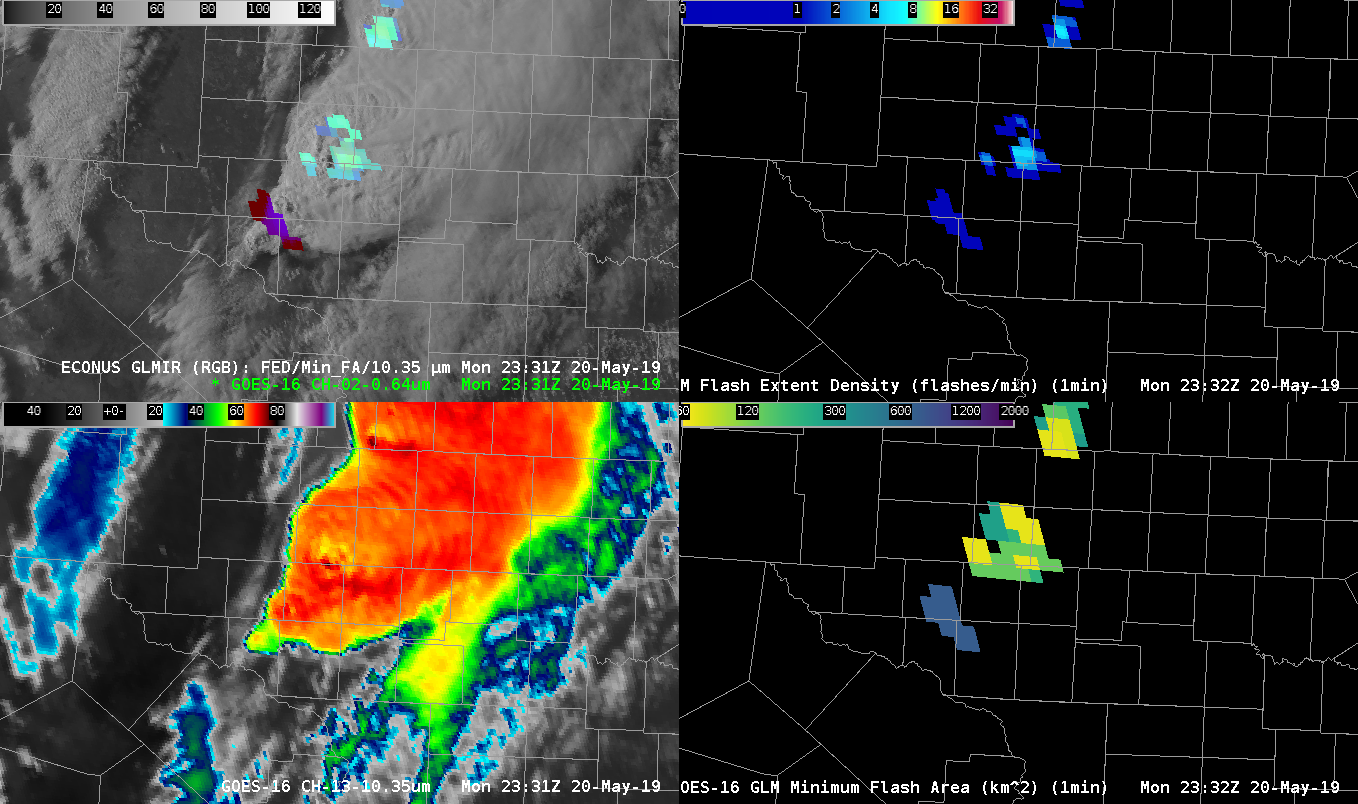
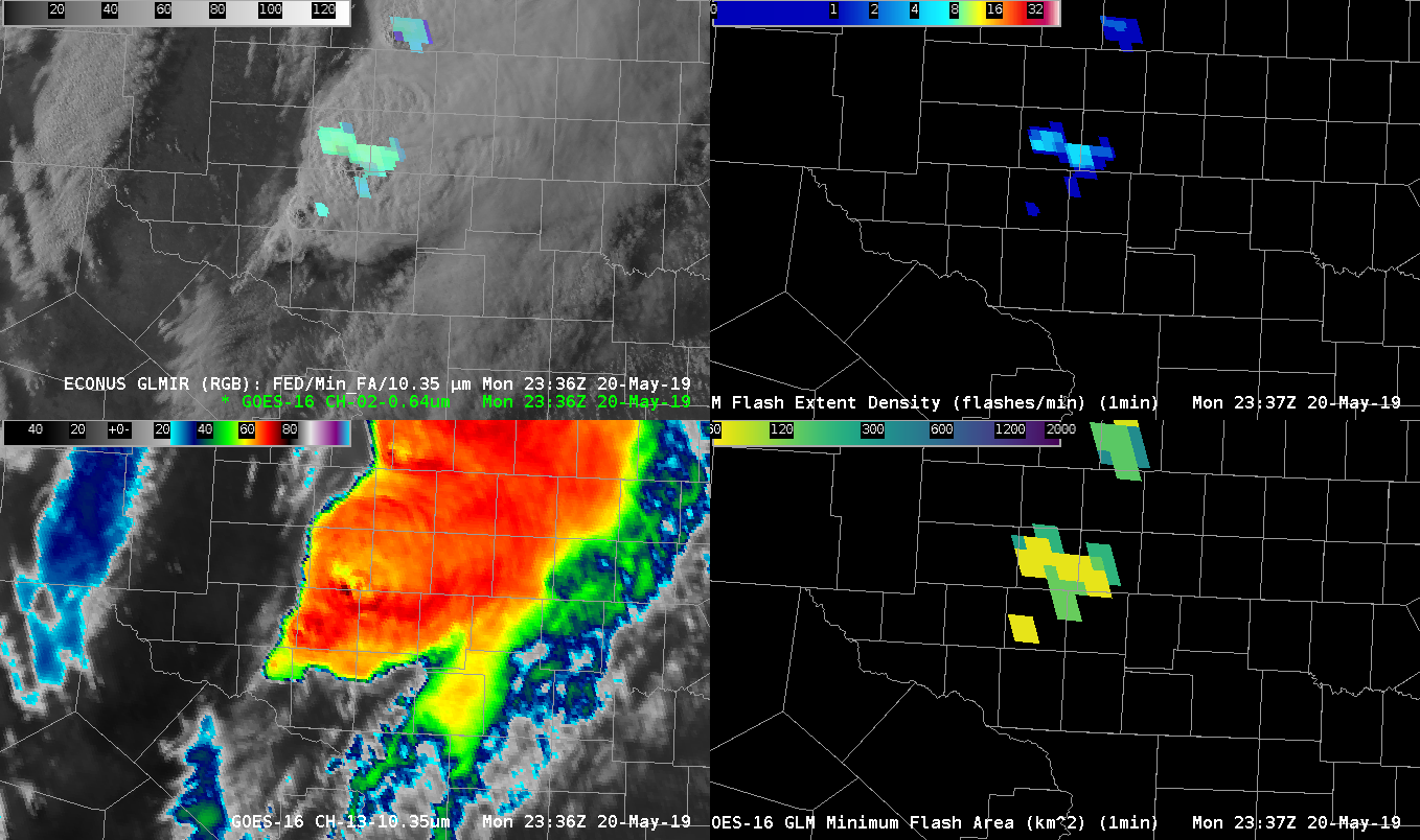
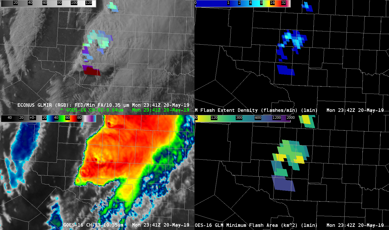
So, here’s an interesting concept…GLM data merged with GOES-16 IR (10.3 um) to create an RGB. I think I like it! Data fusion concepts like this are increasingly important in data-heavy AWIPS, especially during severe weather events and for situational awareness activities. So, this RGB uses Flash Extent Density as the Red component, Minimum Flash Area as the Green component, and 10.3 um imagery from GOES as the Blue component. The RGB has been tailored such that high FED results in increased red values, while Minimum Flash Area is reversed with respect to green colors (lower values equal increased green) and the IR temperatures from the 10.3 um band are also reversed so that lower temperatures result in higher blue colors. So, for example, the end result is that high FED, low minimum flash area and cold IR temperatures result in brighter colors (near white) that physically indicate intense lightning, collocated with intense updrafts and cold cloud tops. Meanwhile, anvil-type lightning (cold cloud tops, generally low FED and high minimum flash area result in colors more towards purple. Colors leaning towards reds, yellows are relatively young, but intense convection in new, warmer convective cloud tops. This shows up well, watching young convection feeding into an area of ongoing convection at the tail end of the convective complex today. Ok…I’m writing this at the tail end of activities today, so I had to rush through this. =)
Kris