Low TORP Probability Next to Radar

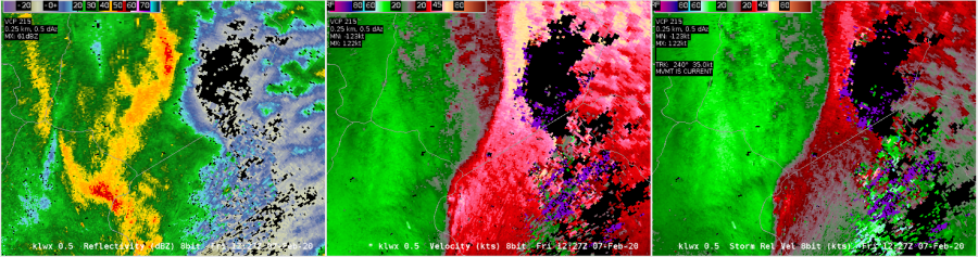
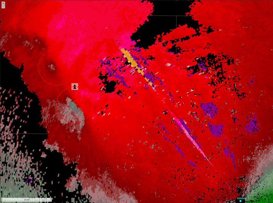
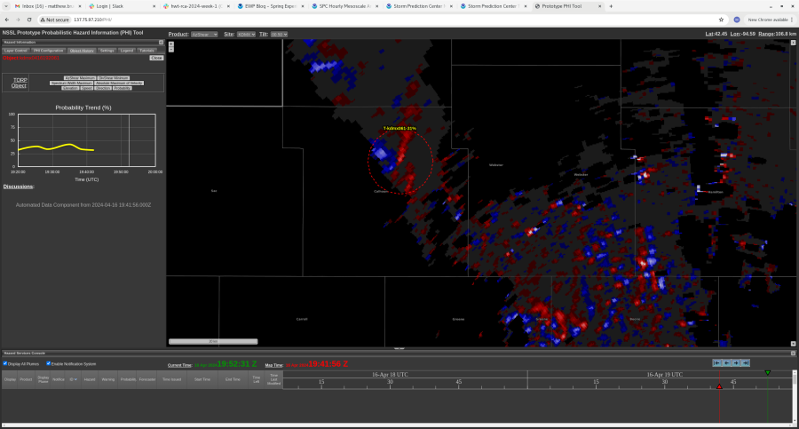
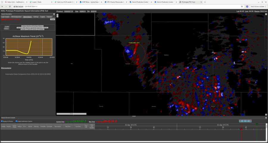
An area of higher AzShear moved close to the KLWX radar at 1221z and TORP struggled to pick up on this. TORP has a known QC to filter out data within a certain range (30km) from the radar, but even when that was turned off, TORP did not have anything. 

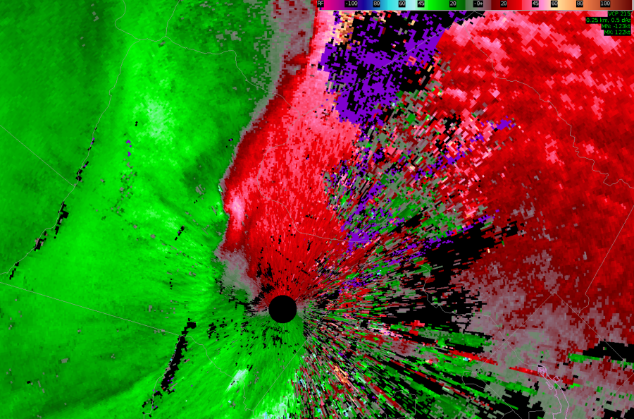
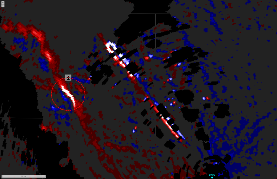
Looking at the velocity data, there is a couplet there just to the northwest of the radar where AzShear is maximized. So, even though AzShear responded well to the couplet, TORP struggled due to the close proximity to the KLWX radar.

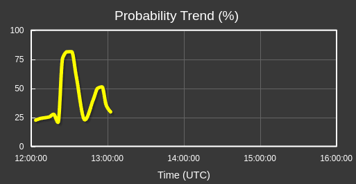
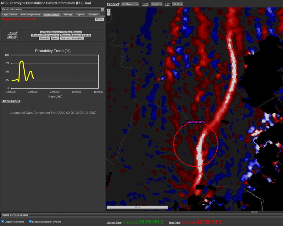
The TORP graph shows that when the couplet with the high AzShear moved farther away from the radar, the probabilities shot up from 25% to 80%. And this couplet did produce a tornado.

-Stormy Surge

SideLobe Example

AzShear exhibits a “blocky pattern” while dual pol shows evidence of a hail core resulting in side lobe contamination for this storm in the DVN forecast area on the afternoon of April 16th.

Posted by Rigel.

TORP and Wind Farms

TORP tried identifying an area with low reflectivity southeast of KDVN at 2040z seemly outside of any storms. TORP peaked at 38% at this time.

Looking at the AzShear data, the pattern look like a wind farm with the blocky data. Fortunately TORP was only elevated for one scan.

-Stormy Surge

Beam Blockage Filtering

An interesting example of beam blockage filtering where an area of higher reflectivities bisecting the beam blockage was assigned a storm identification after the spurious values of AzShear was filtered out while those in the area of lower  reflectivities were not.


Posted by Rigel

TORP Troubles with Extended Distances from Radars

During today’s real time case, one line of storms drifted off into the extreme northeast corner of our CWA (DMX). This corner reported meteorological echoes at about 150  km away (just shy of TORPs max effective range of 160 km). At the southern end of this line, a convincing hook signature with an admittedly broad mesocyclone caught our eye.

The long range line with hooking reflectivity and somewhat broad (but present) rotation.

Despite this, TORP was not creating any objects along this line with our selected radar (KDMX). Upon selecting the option to overlap other objects generated from surrounding radars, other objects appeared north of the hook in question, but not over it. This was a little concerning  as this the sort of feature I would expect to generate at least a low probability object. But this issue is not surprising considering the range away from any of the surrounding radars and how lofted the data is.

AzShear overlaid with TORP objects notably north of the interesting reflectivity hook.

This issue will certainly pose a challenge in areas where there are large distances between nearby radars.

-Wx Warlock

AzShear and Radar Artifacts

AzShear showed an interesting streak of both cyclonic and anit-cyclonic shear exactly down radial from the radar KDVN at 2025z. Just looking at that, it look like an artifact from the base velocity data down radial from the radar.

Looking at the reflectivity and velocity data, the issue seems to be beam blocking to the northwest of KDVN causing the erroneous AzShear values. Good to see that TORP is not influenced by this artifact.

-Stormy Surge

LP Supercell Tornado in Calhoun County, IA

A LP supercell produced a tornado in Calhoun County, IA, on the radar scan shown in a very low Z region with little rotation evident on velocity. TORP got as high as 43% but did not have a notable quick increase as recent tornadic storms did. AzShear increased but with a quick, minimal jump. This is a tough case and, considering that the TORP ingests radar data, without a defined signature on radar it will be tough for TORP to detect anything either. -newt