Pocatello Storms

We’re currently monitoring conditions in eastern Idaho. Right now I’m using various applications to analyze and initialize current conditions. Currently AllSky is showing cape around 1000kj, and PWATS around .80 inches.

That PWAT value on the morning sounding just west of the area was close to .64″. Seeing how moisture levels are lower to west I can interpolate that the moisture values are similar to what’s show on allsky. The allsky 900-700mb also seems to pick up on the relatively moist area in the lower half of the atmosphere.

Looking downstream we’re noticing a line of developing convection using the Day land cloud RGB. It’s helpful to analyze just how high the tops of the storms are getting combined with cloud tops.

Zooming in closer I can examine the few storms that have popped up more closely. The RBG help the differentiate between the ambient cirrus clouds from the growing storms. That might not have been as easy to see using a typical visible view.

The AFA and Minimum flash area maximums are hinting at growing convection just downwind.  That growth leads to me to anticipate further intensification as these storms move into a more favorable environment in eastern Idaho.

As storms begin to intensify probsever eis picking up on the strongest activity. Probsevere began to ramp up for the cell just south pf Pocatella. That combined with traditional radar methods lead me to issues a warning for that cell.

A similar situation unfolded with a south just south of CWA that I debated on warning. The probsevere values did show and uptick. Eventually the storm fell apart as it pushed into southern Idaho.

We’re watching a few cells in the southern half of the viewing area.  As NUCAPS comes in I’m comparing it the allsky cape. The allsky cape is around 1100kj.

The modified sounding is putting out about 700kj of ml cape. While the nonmodified is much lower down to 500kj.

We don’t have a midday sounding to see which one is initializing the best. For what it’s worth. The rap cape output is around 500kj.

The TPW was close to the observed pwats as well. It was outputting about .65″.

The FED has been fairly low this afternoon which isn’t typical for what I have been usually see. However, the AFA and the MFA are higher indicative of growing updrafts. I’m thinking the FED might be lower because of potential hail in the updraft.

The cell pushing out of Freemont county Idaho continues to intensify as it pushed into Montana. Both the MD, and NMDA were picking up on a high meso that was clearly seen on SRM.


The CPTI was showing high probabilities as well.  I still wasn’t as concerned about a tornado threat due to how high the base of the storm was. It was interesting to see though.

The forecast cape and cin values came in from the NUCAPS,  but it wasn’t usable for my area because their was a lot of missing data.

The actual Pocatella office issued a warning for Freemont county. Using typical radar methods the storm didn’t look like it warranted a severe thunderstorm warning, but satellite and MFA showed new convection was still firing up. Right after looking at satellite there was a report of a 54mph wind gusts.


Lightning over the Mountains

Having the different lightning products from GLM as well as data from ENTLN allows you to pick out which cells have started producing lightning.  One flash up in northern WY on this image, the dot in the upper left, did show up in the FED data a couple minutes later.

Charley

Western Wyoming Cell Developing

IR imagery showing a taller/colder cell in western Wyoming.  KRIW radar just switched from VCP 35 to 12.  Peak Z aloft now only around 30.  Lightning data, below, shows relatively low FED, but higher TOE, with peak values in the 300’s, similar to some of the storms we saw yesterday.

One other thing to note in these, is the relatively low FED and number of ENTLN/NLDN flashes.  That doesn’t mesh with the brightness of the TOE.

Charley

Springfield Illinois Storms

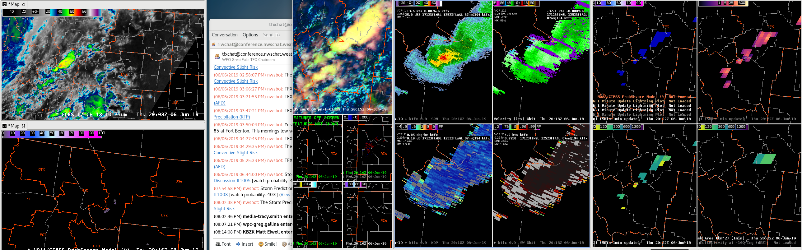
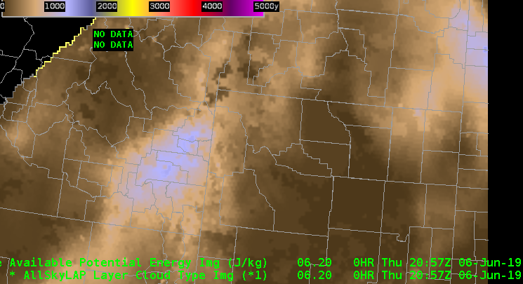
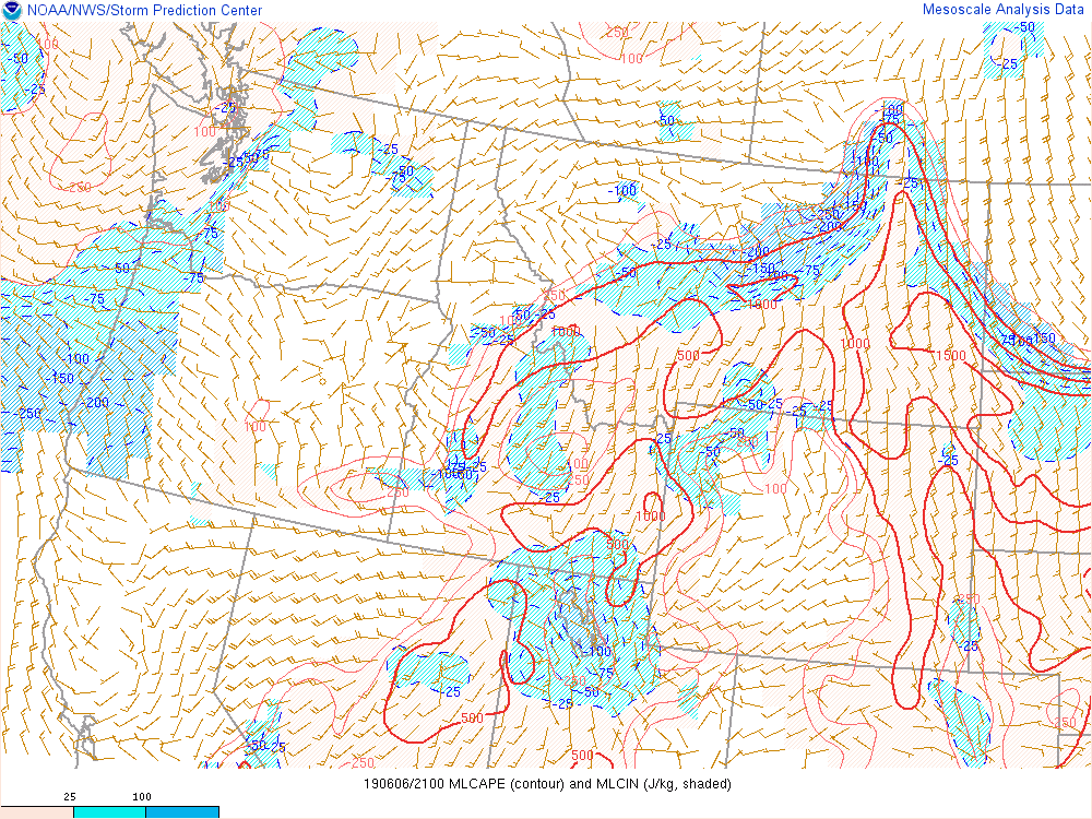
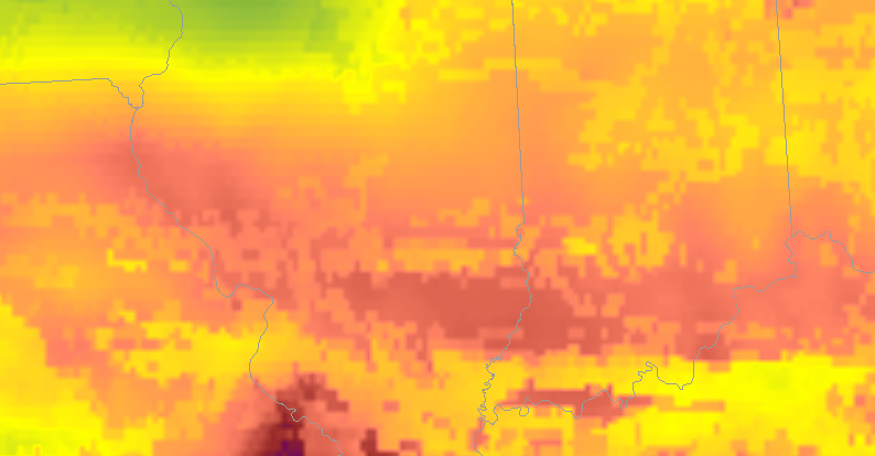
Right now I’m analyzing the various new products to nowcast where and when storms will intensify. Currently I’m comparing ALLsky cape to the mesoanalysis from the spc. Right now the mesoanalysis is higher with cape compared to allsky. Over our area the it’s cloudy so the it’s taking data from the GFS.

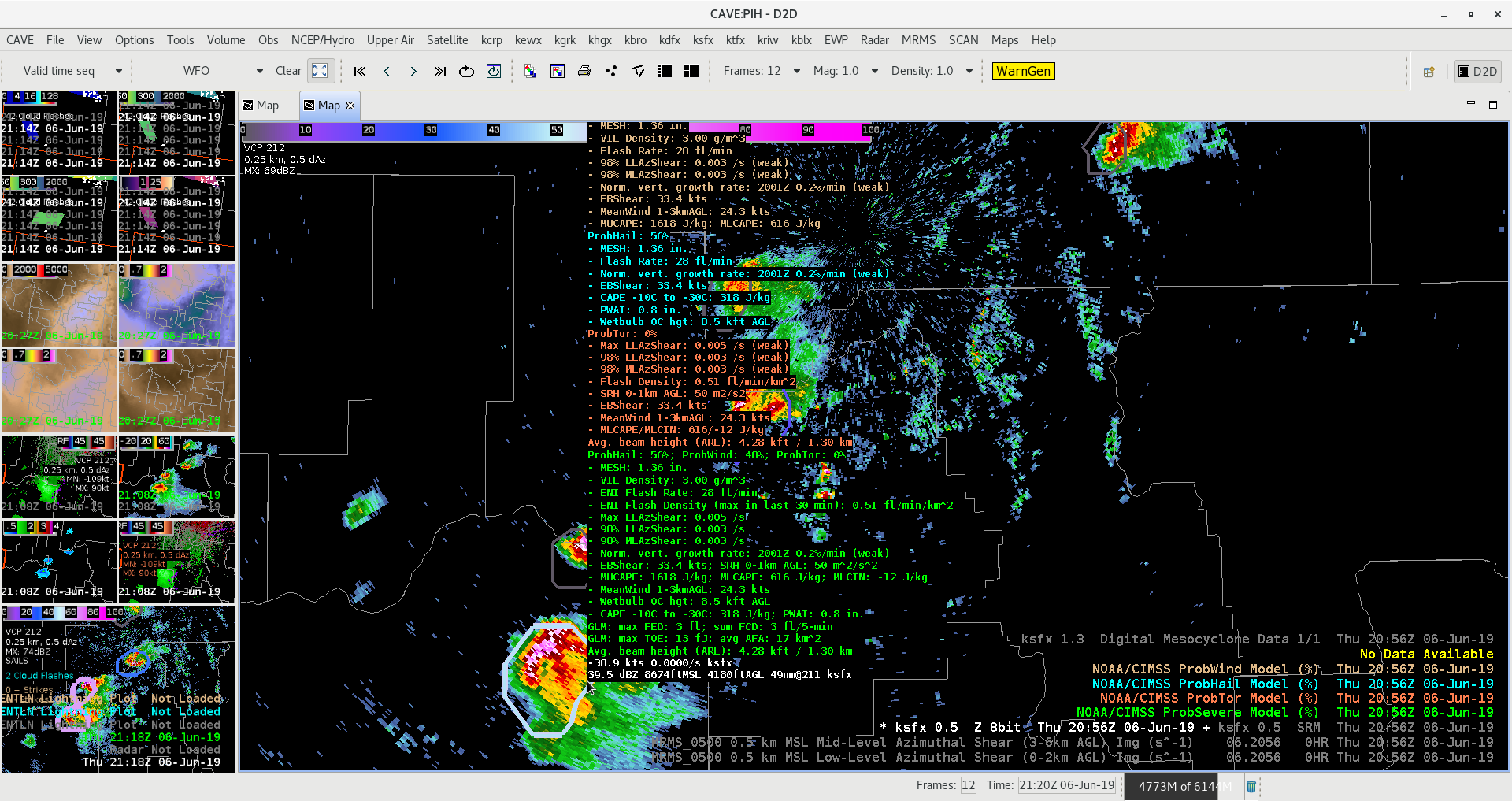
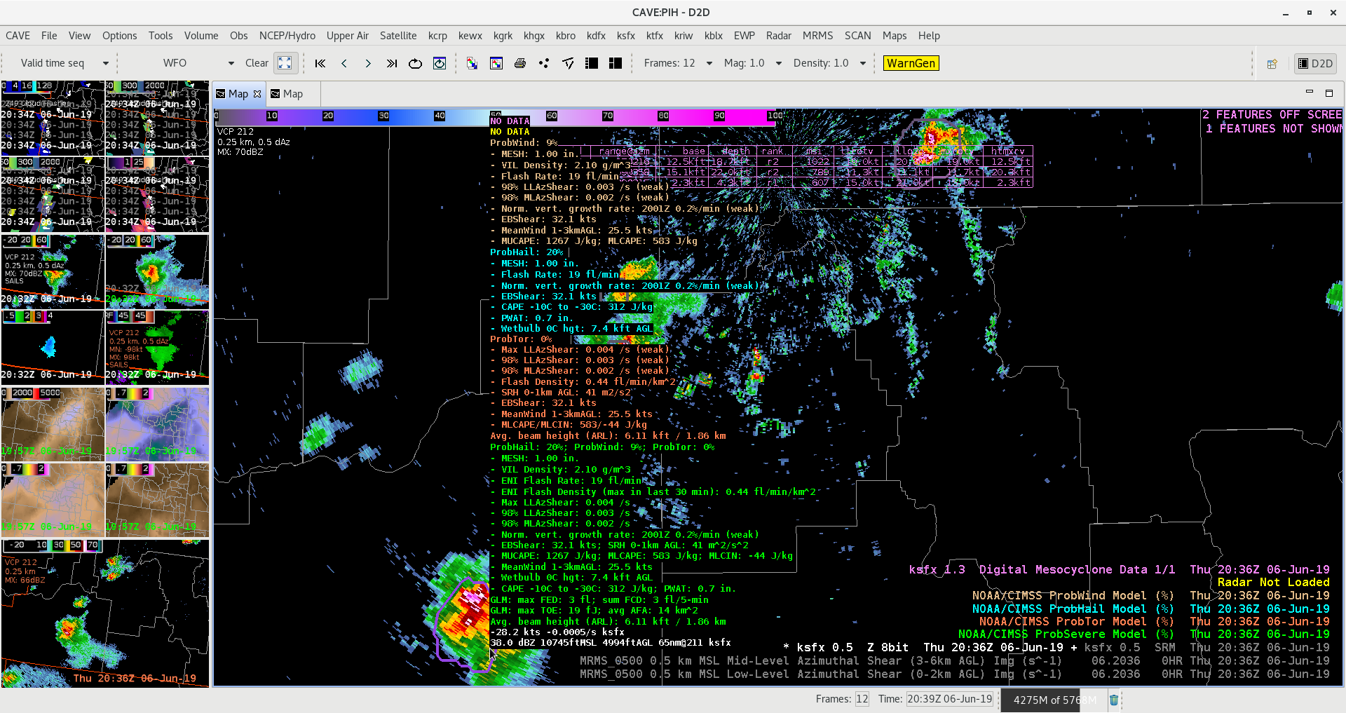
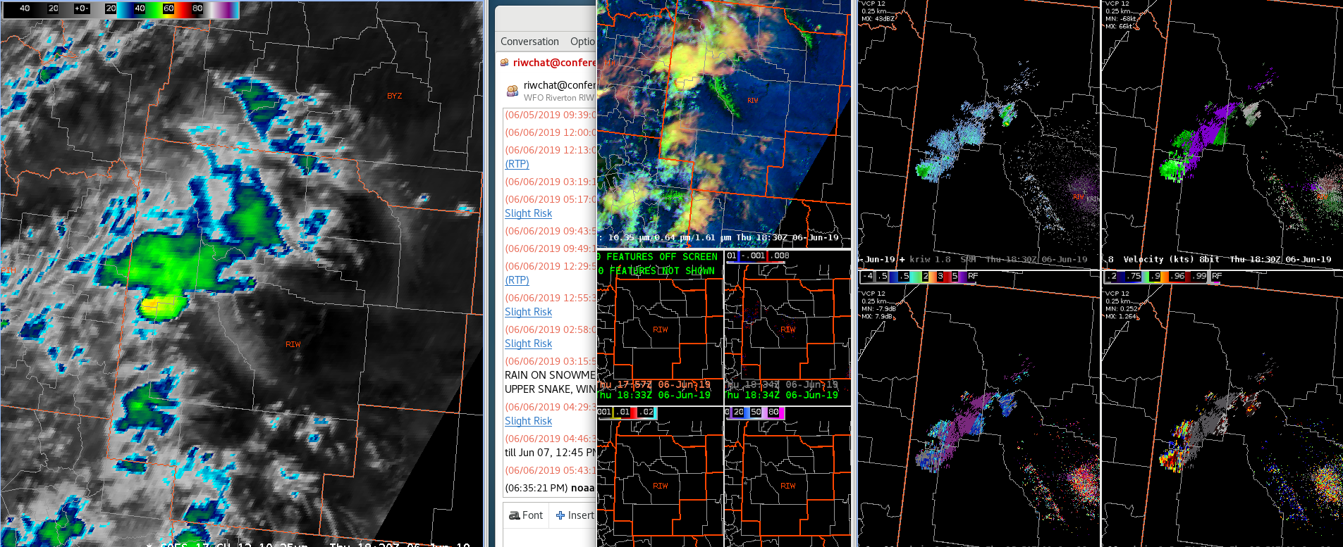
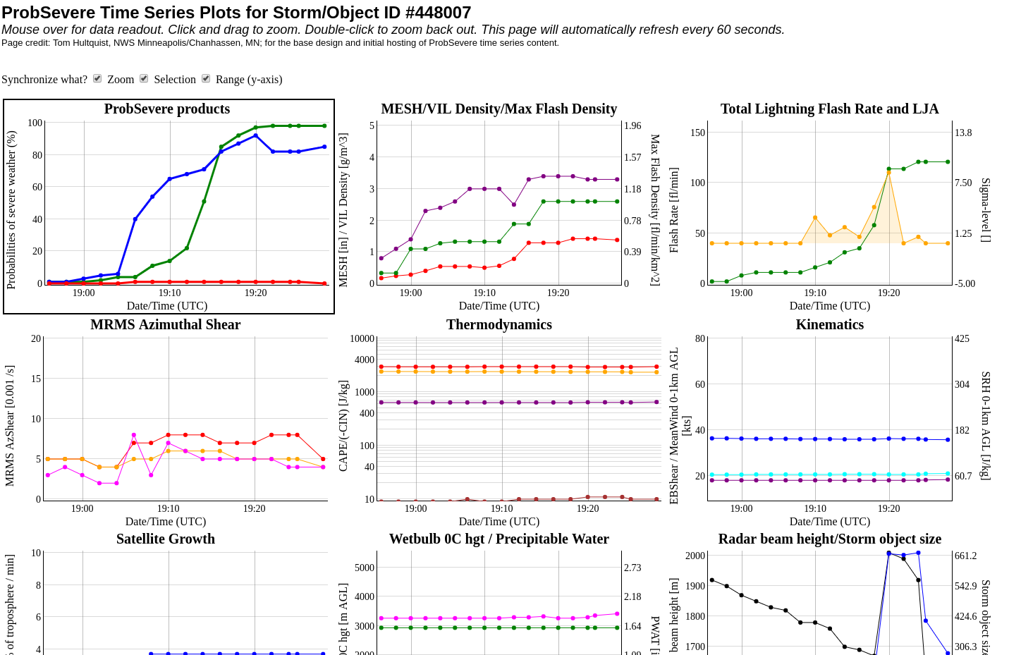
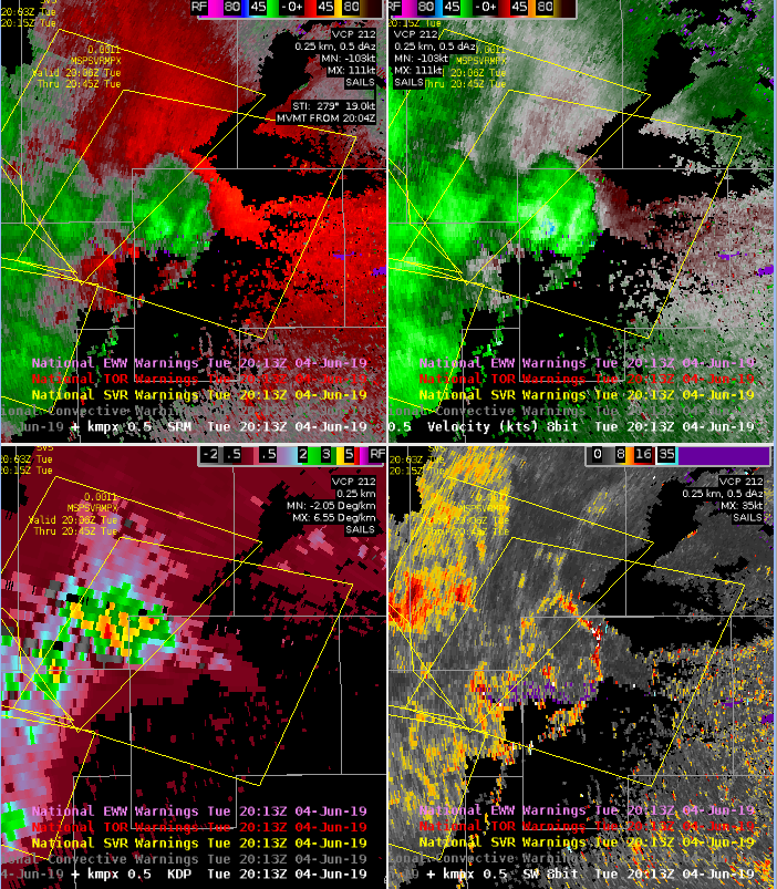
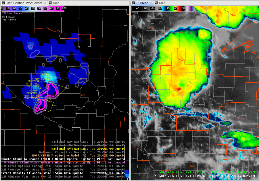
A cell in our western counties ramped up very quickly while our computers were down. Prob severe immediately directed our eye to the cell. The probsevere lined  up with an uptick in vil values and velocity.

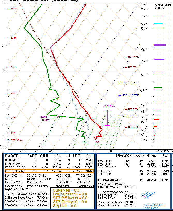
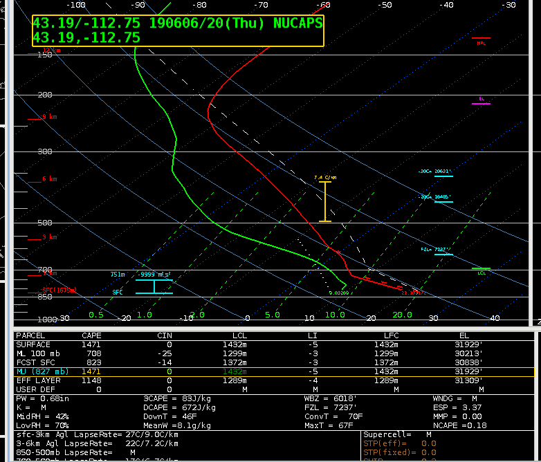
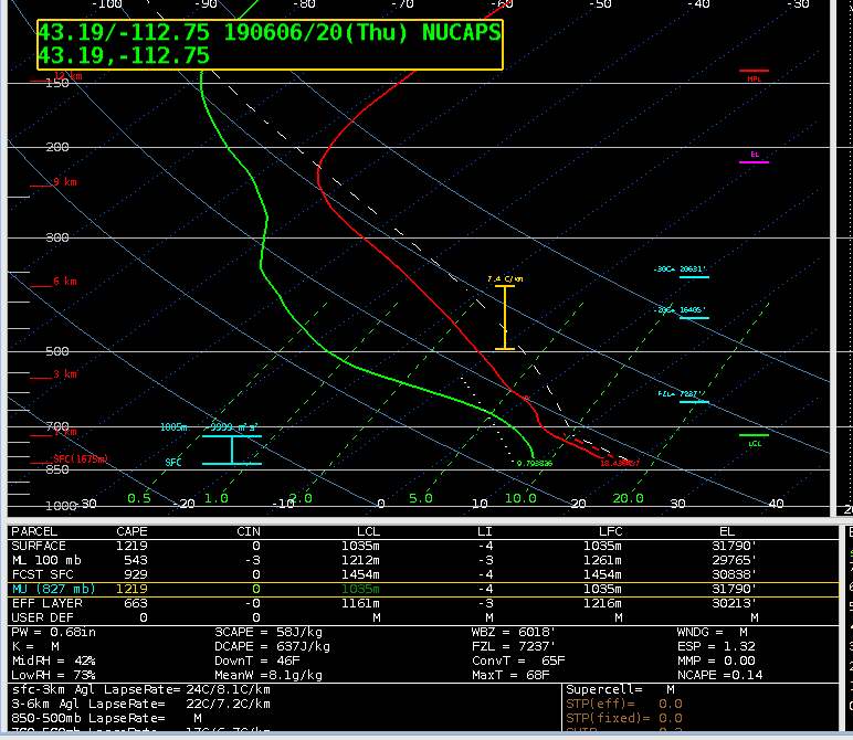
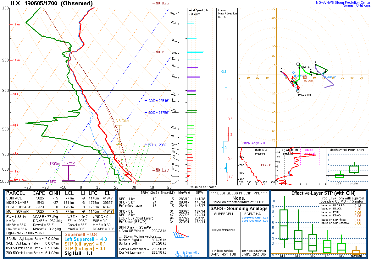
I’m comparing the actual sounding to what’s shown on nucaps, and allsky to see what’s initializing the best. The actual sounding shows 3025kj of surface lavyer cape and 1453 of mixed layer.

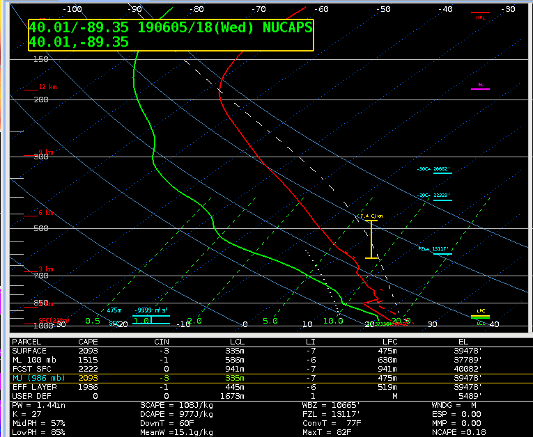
Around the same time allsky shows a similar value of cape.

The modified sounding was closest to the actual sounding with 1515kj of mixed layer cape

The nonmodified sounding is much lower when it comes to mixed layer and surface cape. In the case the modified sounding was more reliable and gave a more accurate picture of the current state of the atmosphere.

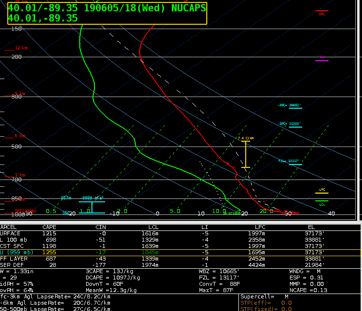
The all sky cape was much higher, around 2300kj.

That increase might be due to the fact that the sampled area of interest was filled in by the GFS. Whatever input the GFS was taking into might have lead to it overestimating the amount of CAPE.

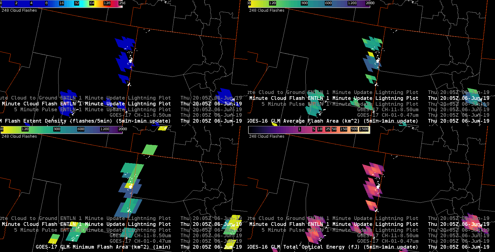
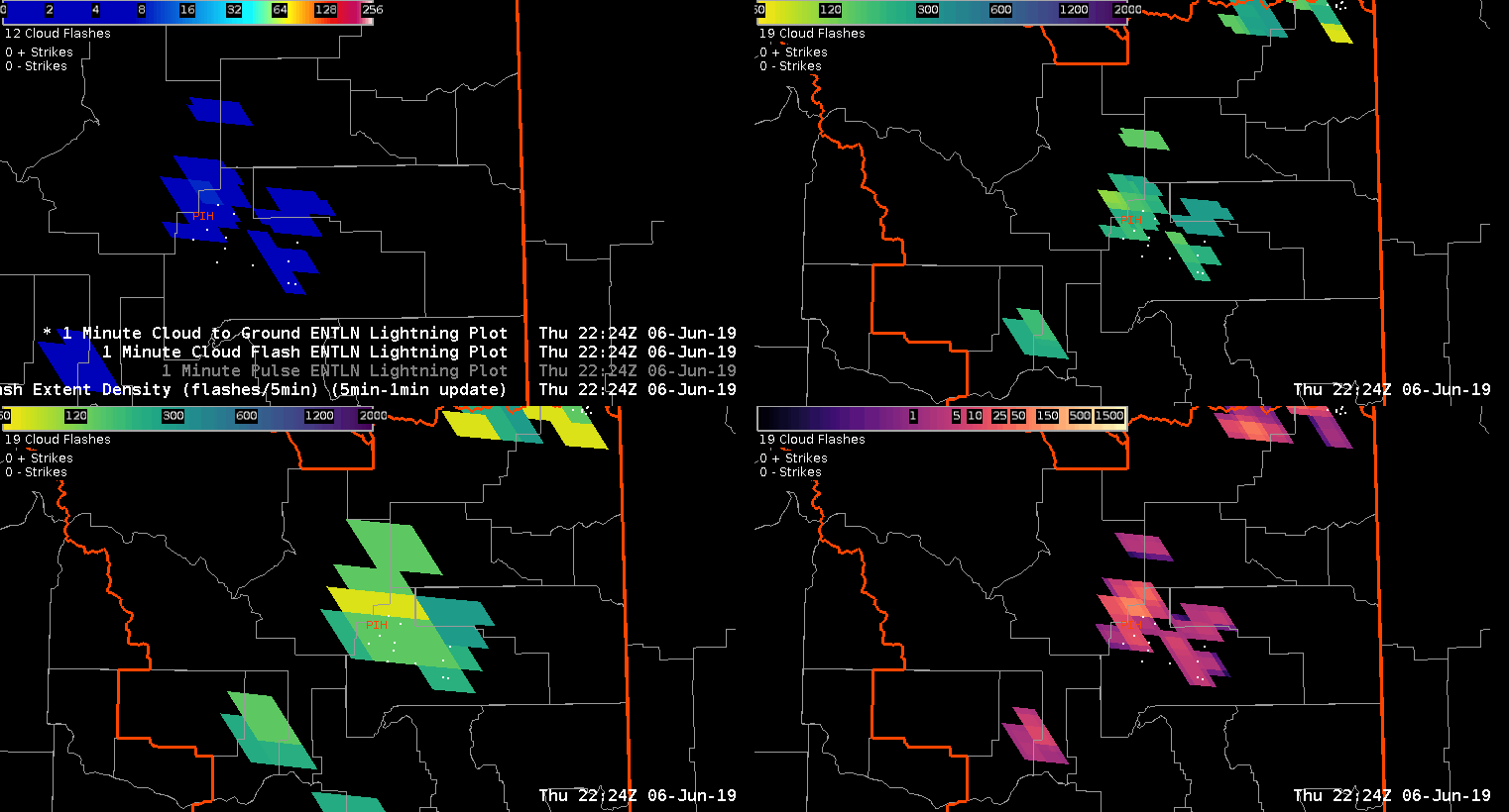
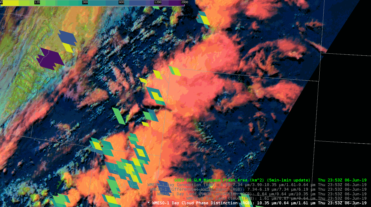
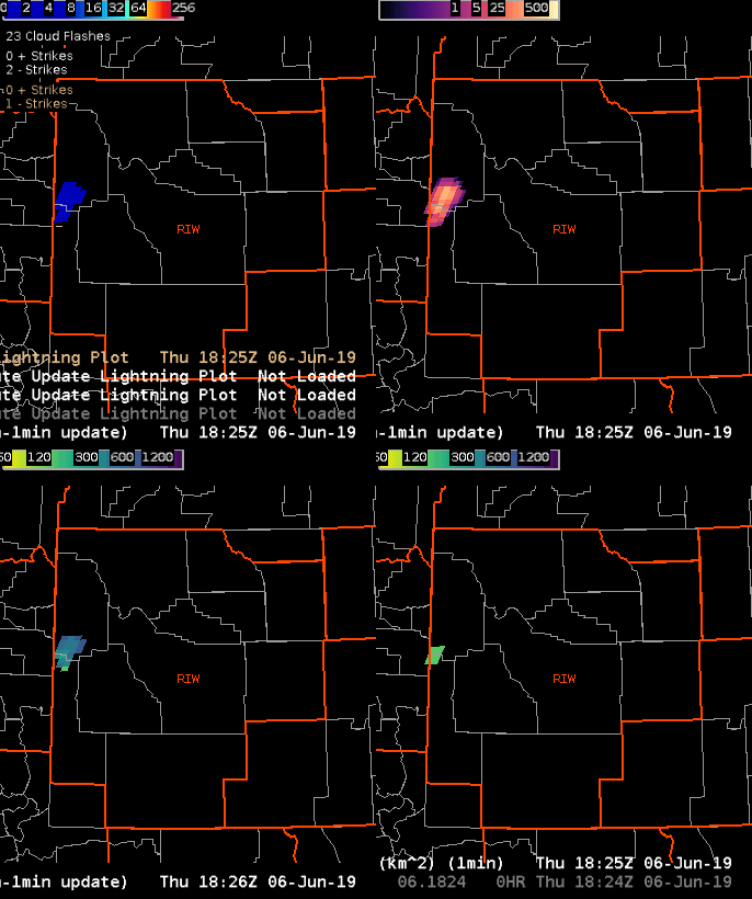
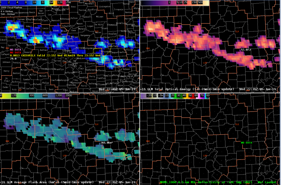
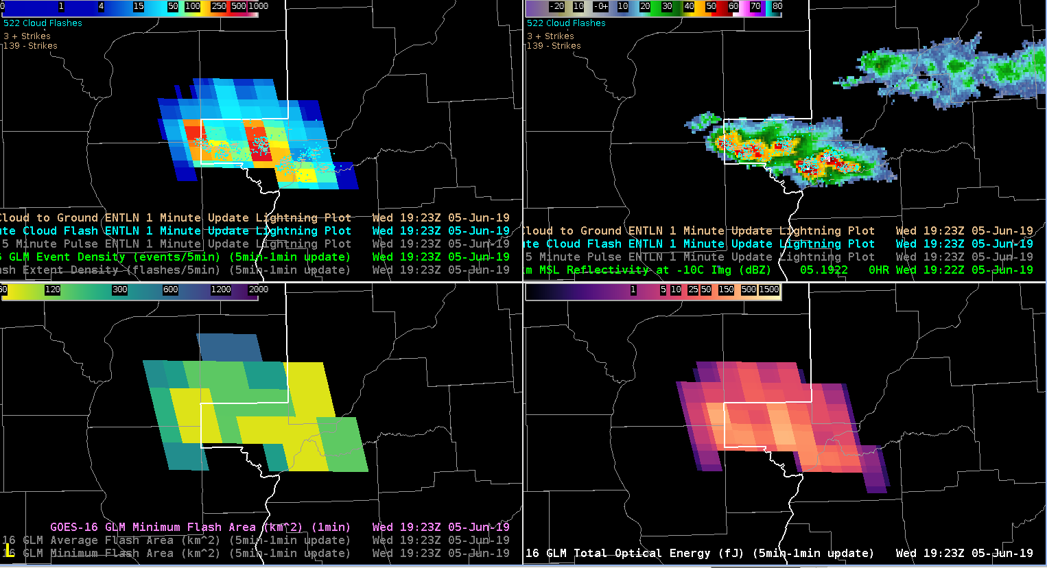
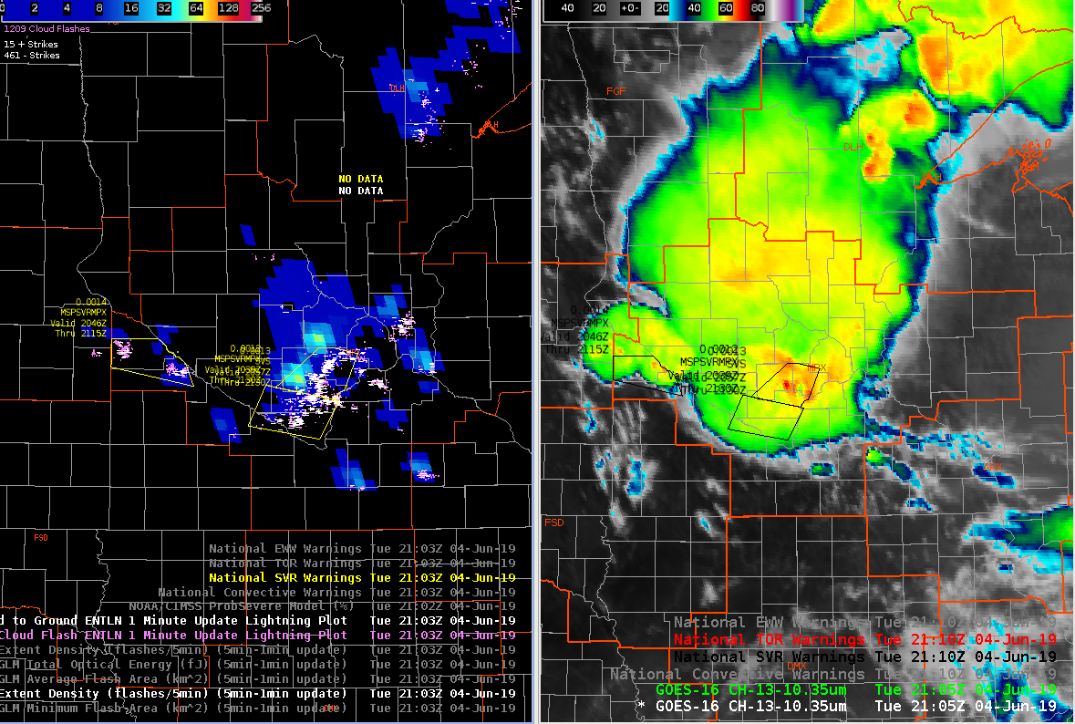
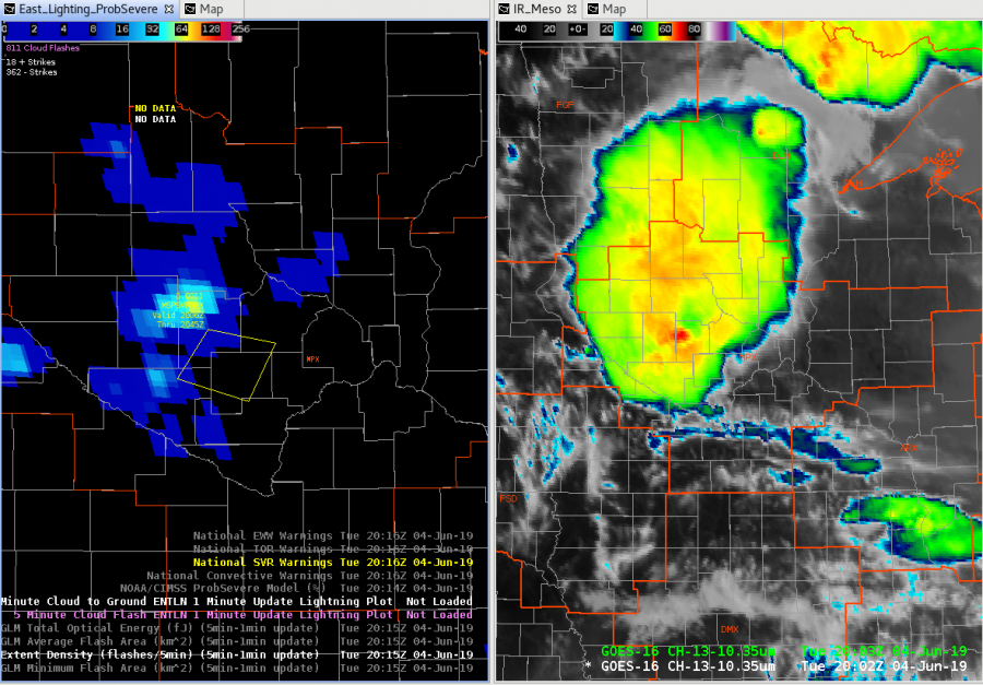
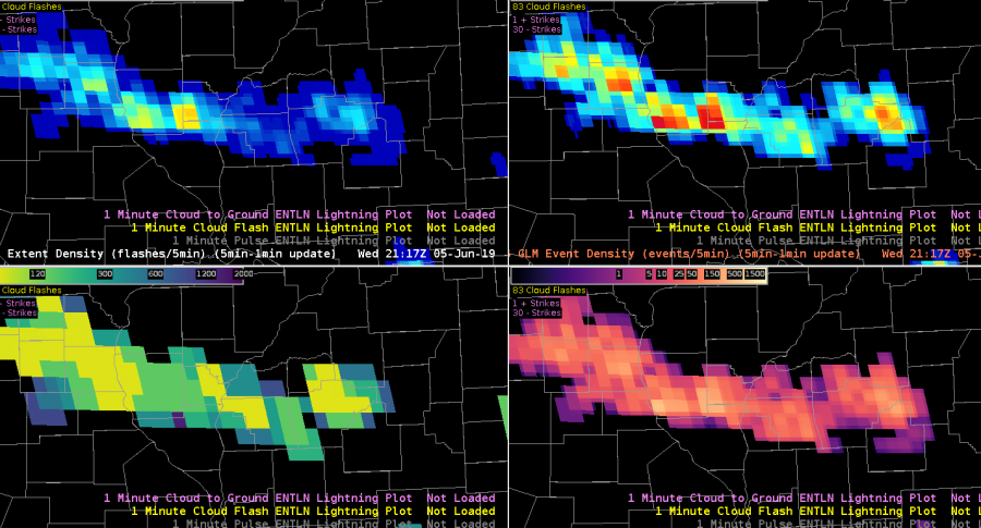
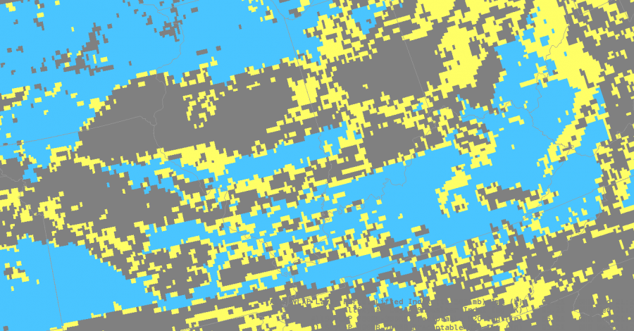
I’m also looking at GLM products to see trends with convection. The combination of event density and GLM minimum flash area help me to see the rapidly growing updrafts as well as cell that are producing hail. That’s the case right now. My warned cell is producing penny size hail.

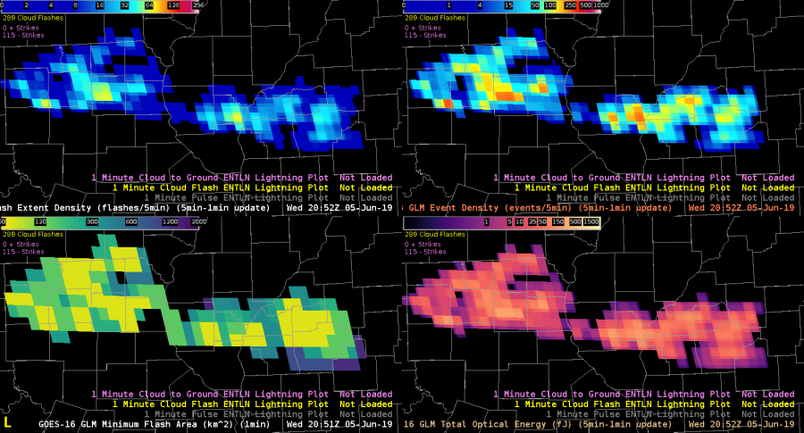
About an hour later the FED Is starting to pick up on longer flashes, but the event density is still showing higher values. The lines up with satellite which shows overshooting tops, but storms are overall keeping their intensity. The overall trend combined with looking at stability indices aids me in nowcasting that storms will at least maintain their strength over the next hour or so.

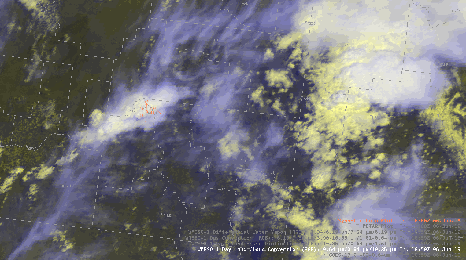
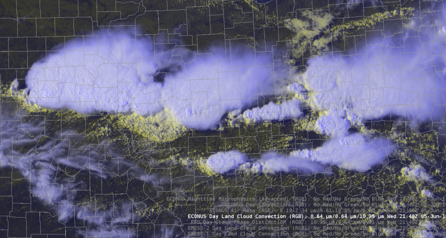
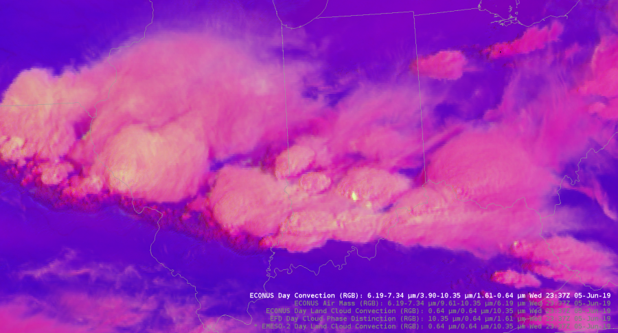
The Day Land Cloud convection RGB was helpful in analyzing different cloud tops. The color scale highlighted the thin cirrus compared to the lower thick clouds. It also dipicted the outflow boundary from our southern storms very well. It gives much more detail to the cloud types compared to the visible satellite.

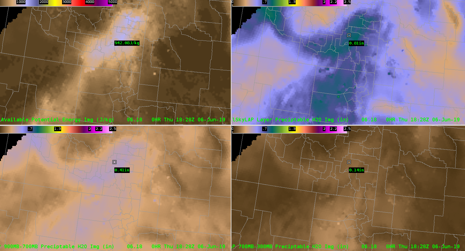
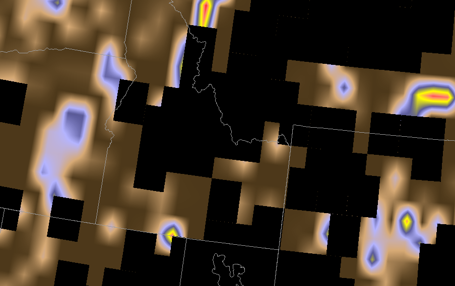
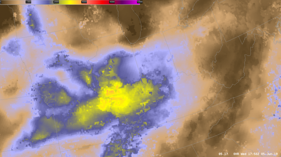
Today I also got the chance to analyze and compare the merged TPW precipital water with the allsky.

During the afternoon the PW values stayed fairly steady across the northern half of the state while moisture increased in southern Illinois.

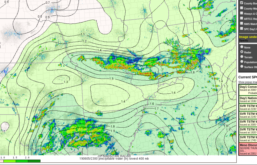
The TPW decreased PWATS to close to 1 inch as storms moved through. T

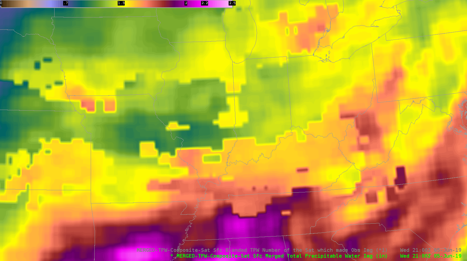
That data was sampled in a cloudy environment.

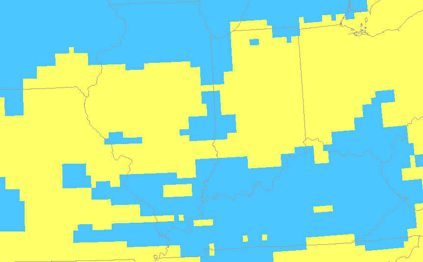
Meanwhile, the AllSky does show a decrease in PWATS but’s farther north compared to what actually happened. That data was pulled from the GFS since it was in a cloudy location. It was helpful to see how each product performed in this environment. It’s nice to have access to both in order to see which one has the best handle of the current atmosphere. That initialization helps me monitor trends and nowcast.

As storms moved south out of my DMA I used Day convection RGB just to monitor growing cells. It was clear to see the strongest storms because they had the bright yellow maxes.

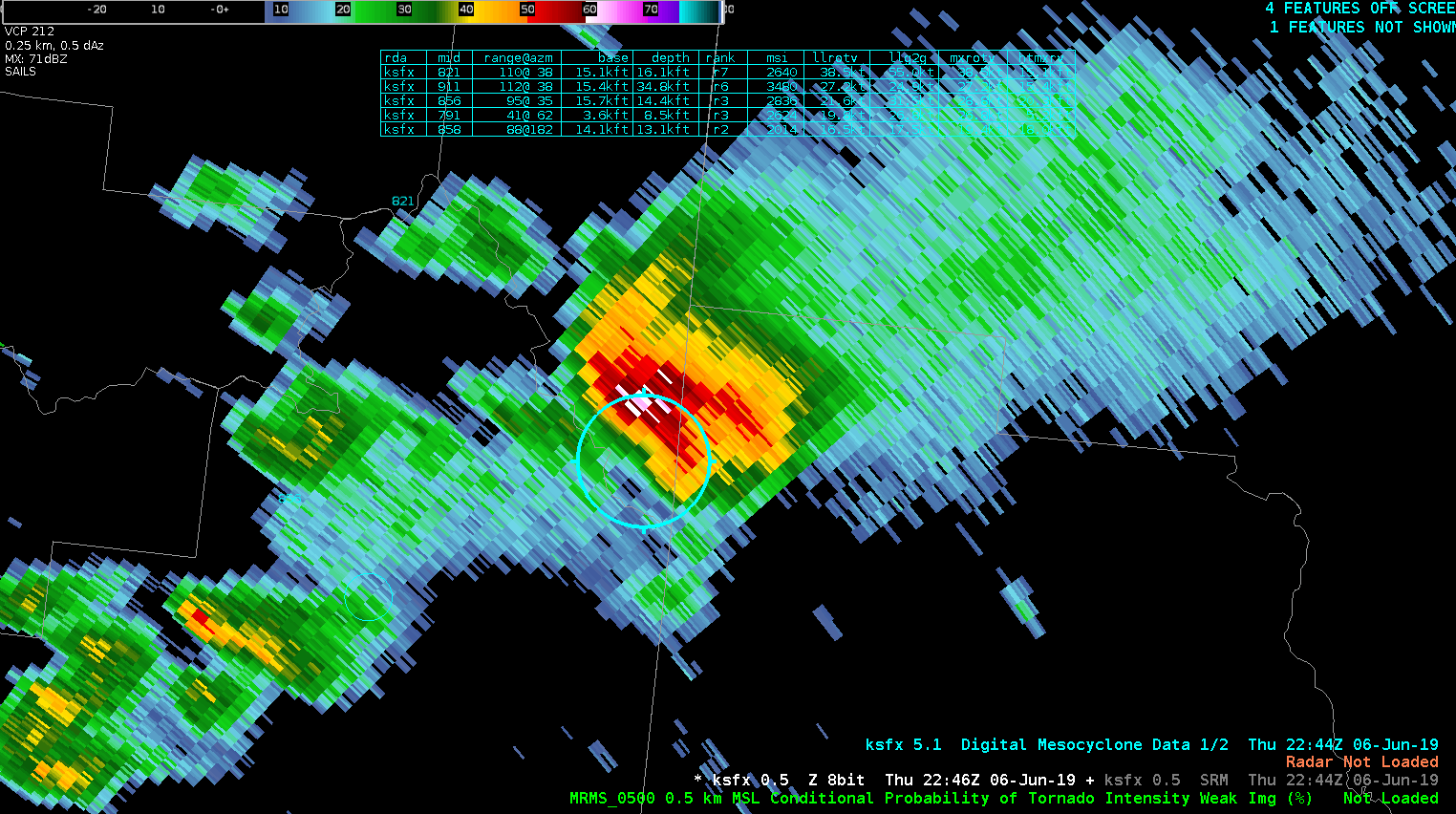
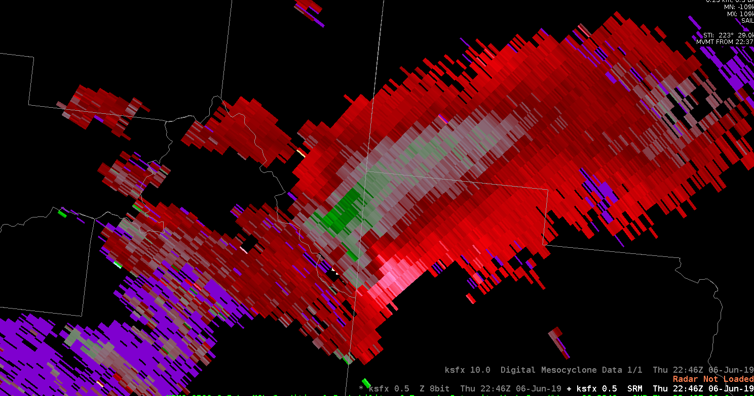
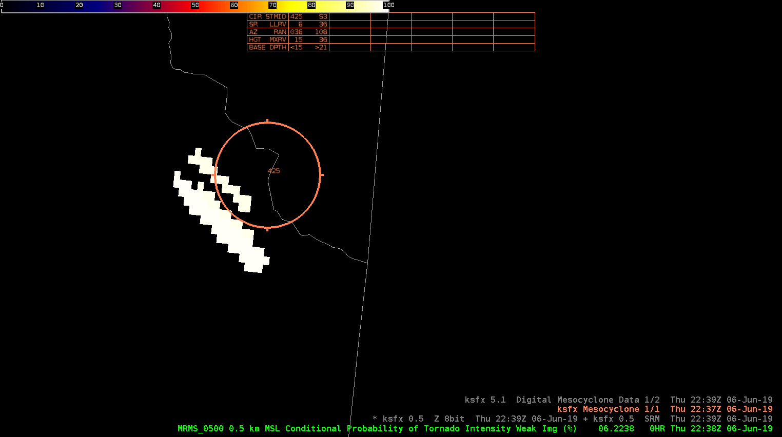
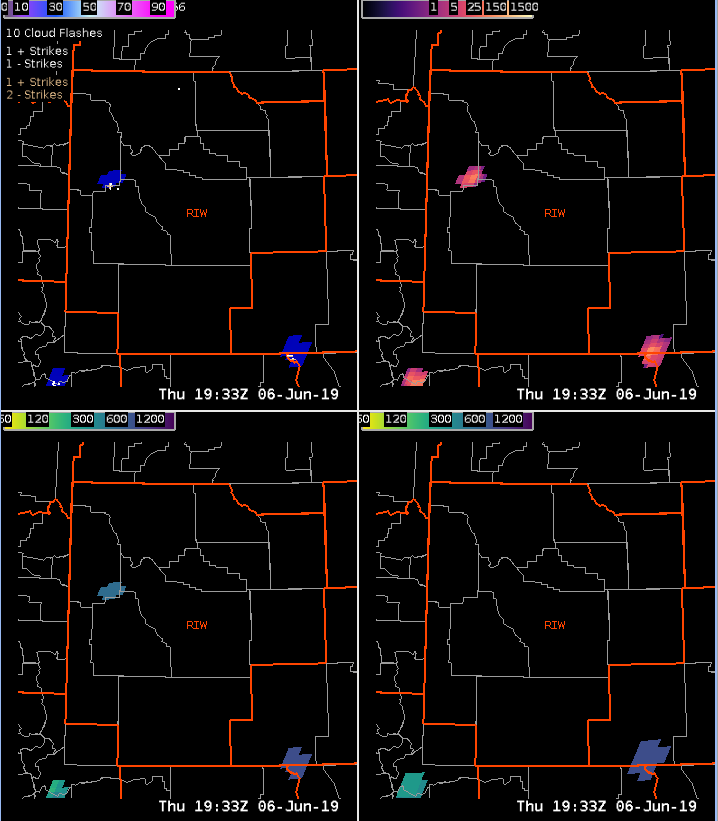
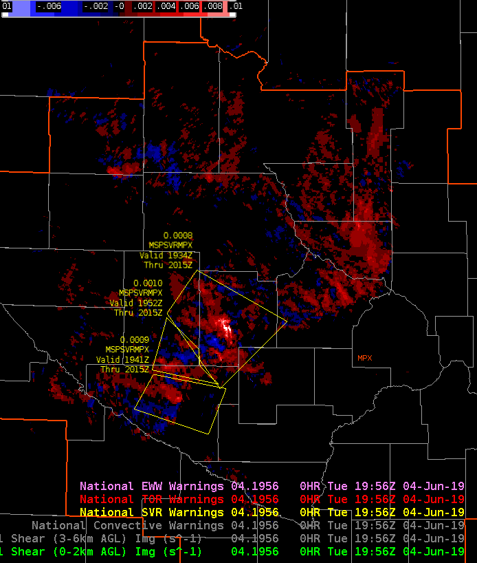
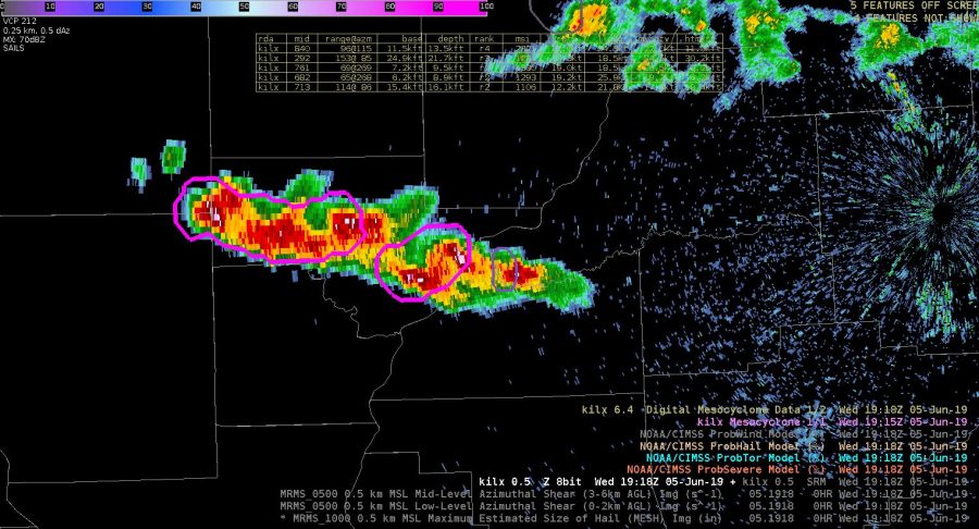
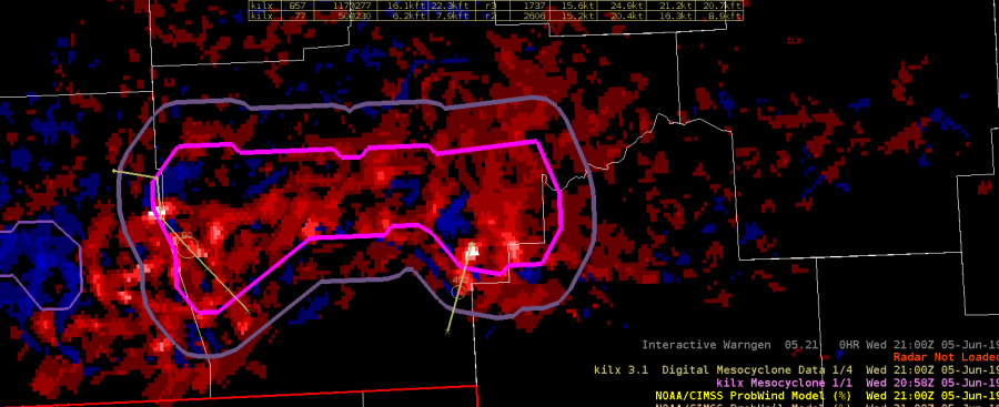
Earlier in the day was able to compare NMDA with the low level azshear. Tornadoes were’t a major threat, but the NMDA did line up with peak areas of Azshear. That storm did produce wind damage, and strong wind gusts.

Taylor Johnson.

ILX GLM Case


(Top Left): GLM Event Density w/ ENTLN Lightning Data; (Top Right): MRMS -10C with ENTLN overlayed; (Bottom Left): GLM Minimum Flash Area; (Bottom Right): GLM Total Optical Energy

Had a unique opportunity to watch a line of strong to eventually severe storms ignite and strengthen rapidly along an old outflow boundary this afternoon using GLM data. It was interesting using the above 4 panel display to not only witness the ignition, but also the strengthening of each sequential cell along the line. By utilizing the GLM Minimum Flash Area (Bottom left) 1 minute imagery in a loop, we were able to sample the early-onset updraft core strengthening of each sequential cell along said line, and watch the event density jump up in accordance. It was also interesting to utilize the Prob-severe lightning jump data in time-series format to watch in a real-time basis. Suggested best practice would be to make these 4-panel layouts available for events like this.

FED, ENTLN comparison

Noticed the FED was matching up well with ENTLN data in our eastern cells, but then the cells to the west should have been electrically active as well.  ENTLN data shows several flashes, but FED from GLM is minimal.


Charley

Perhaps tornadogenesis soon?

Lightning on FED starting to go up again, right as cell with rotation starts to meet up with east-west oriented boundary to the east of that cell (see bottom right spectrum width product).

AzShear product following that rotation over time well…watching for increase in intensity there.