The below picture shows an example of some of the products that emergency managers and broadcasters are evaluating this week for severe weather related decision making. Each day, NWS forecasters produce these products during two 60 to 90 minute periods – one based on an archived displaced real-time case, and the other a live weather scenario. Over the last two days, both of the live weather scenarios were in the lower Ohio Valley region.
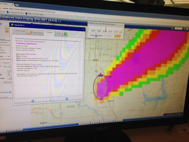
While NWS forecasters are producing forecast information in the HWT, the EMs and broadcasters are in two separate rooms, analyzing and utilizing the forecast information in job related tasks. Using the NWS Experimental Data Display (EDD), developed by WFO Charleston, WV, the EMs and broadcasters can view not only the probabilistic hazard information in various graphical formats, but also prototype text-based messaging based on the NWS Hazard Simplification project. Social and physical science researchers are also in each of the three rooms, working on research goals that will help explore a number of the social and physical science issues related to FACETs.