The data here are provided in three different formats for ease of use. The shapefiles, Google Earth KML, and comma separated values (csv) all provide the same data.
By downloading and using the Flash Flood Observation Database, and components therein, I agree to the data usage policy specified at FLASH Flood Observation Data Usage Agreement as well as more general usage policies established within NOAA and the USGS.
Differences from 2011v1: USGS data updated to extend through July 2013. USGS gauges from previously missing states including Alabama, and the Dakotas backfilled. NWS Storm Data extended through July 2013. Original event and episode IDs from Storm Data added to this version. Data provided in single national file for all points and polygons instead of by 2-digit HUC. SHAVE data is unchanged from 2011v1.
| Data Type | Shapefile | KML | CSV |
| NWS Flash Flood Points | nws_ff_pts_shp.zip | nws_ff_pts_kml.zip | nws_ff_pts_csv.zip |
| NWS Flash Flood Polygons | nws_ff_poly_shp.zip | nws_ff_poly_kml.zip | nws_ff_poly_csv.zip |
| USGS Metadata | usgs_meta_shp.zip | usgs_meta_kml.zip | usgs_meta_csv.zip |
| USGS Event Data | usgs_events_shp.zip | usgs_events_kml.zip | usgs_events_csv.zip |
| SHAVE metadata | shave_impacts_metadata.txt | ||
| SHAVE Event Data | shave_shp.zip | shave_kml.zip | shave_csv.zip |
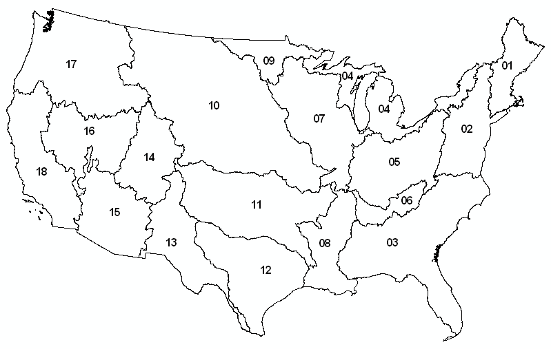
2-Digit HUC Basins for Reference