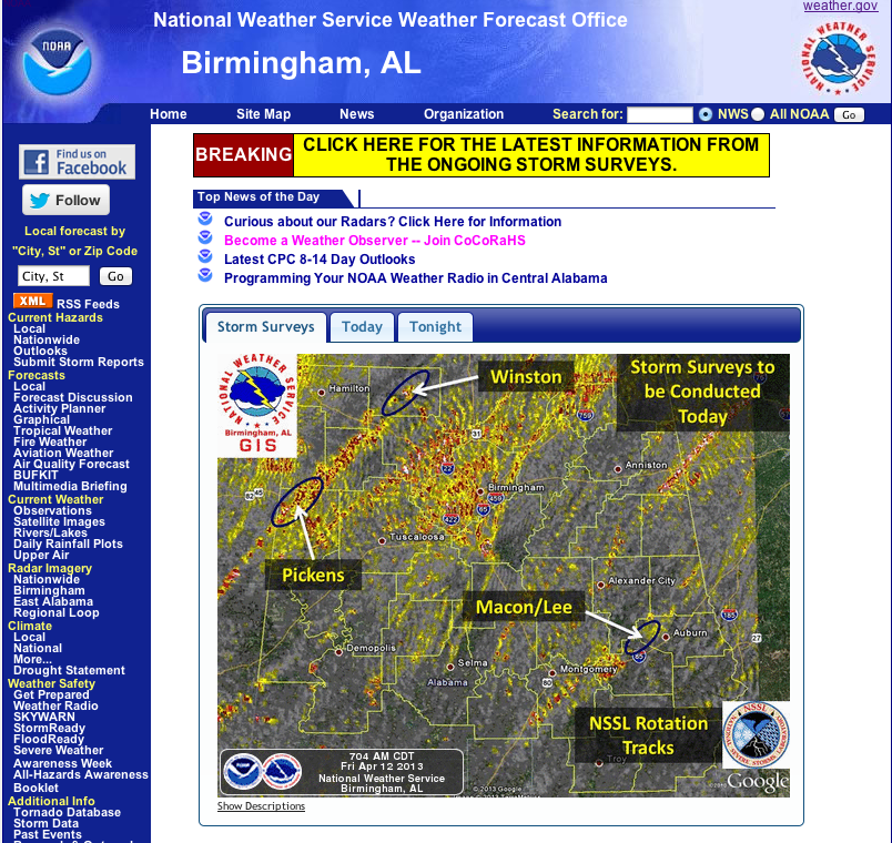
The NWSFO in Birmingham, Ala. used an NSSL product to plan surveys of damage caused by the tornadoes yesterday. NSSL’s On Demand is a web-based tool that can be used to help confirm when and where severe weather occurred.
Bright reds and yellows show more intense circulations.
On Demand uses data gathered and sorted by NSSL’s Warning Decision Support System-Integrated Information (WDSS-II) to estimate the tracks of rotating storms and where hail fell. The rotation tracks or hail swath data can be overlaid on high-resolution street maps in Google Earth/Maps to pinpoint areas affected by the hazardous weather.
The WDSS-II system receives data in real-time from the nationwide networks of weather radars, satellites, surface observations and lightning detectors. WDSS-II then processes, analyzes and displays the data in a way that is useful to people who need to diagnose severe weather quickly.
The growing list of users include other NWSFO’s, emergency responders and the American Red Cross.


