For the past few weeks, Darrel Kingfield and Dr. Kristin Calhoun from CIMMS/NSSL and Dr. Eric Bruning from Texas Tech University have been working alongside forecasters from the National Weather Service (NWS) Forecast Office in Lubbock, Texas, to generate and integrate real-time 1km lightning products into the Advanced Weather Interactive Processing System-2 (AWIPS-2). AWIPS-2 is the weather forecasting, display and analysis package currently being used by the NWS. The team pushed hard to get these products functional for potential severe weather on April 16 and were successful.
Two products — Flash Extent Density and Flash Initiation Density — are gridded visualizations of total lightning data from Lightning Mapping Arrays (LMA). There are several arrays across the U.S. that are able to map the three-dimensional shape, extent and development of branched lightning channels. These data are an essential component of modern lightning detection and physics studies, because they reliably map the extent of the in-cloud charge reservoirs tapped by each lightning flash. Both of these products have been successfully evaluated in the Hazardous Weather Testbed.
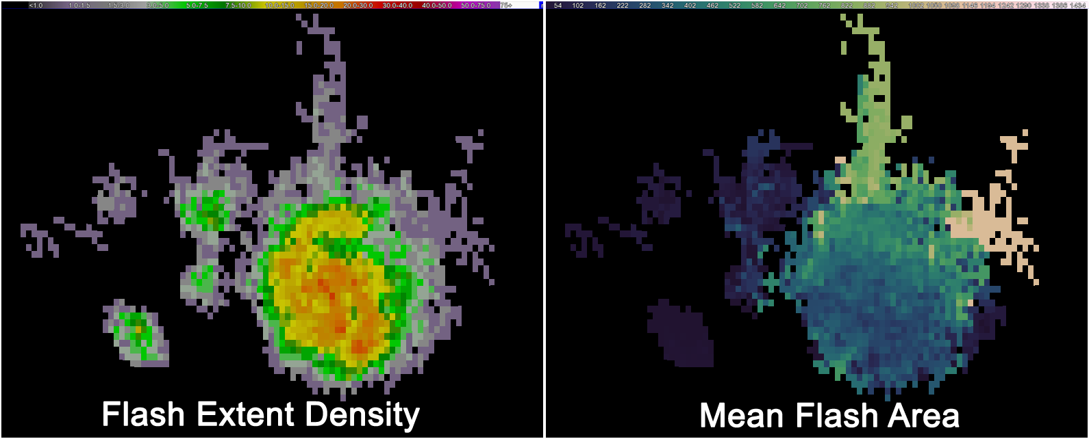
A third product, the experimental Flash Area product from Texas Tech University, was also integrated into AWIPS-2. Forecasters have seen in the LMA data that small, compact flashes are mostly associated with robust or developing convection. As thunderstorms mature and reach the subsequent dissipation stage, the flash area starts to increase. The transfer of these products to operations will provide the developers, researchers and forecasters with the opportunity to learn more about how total lightning products can be utilized in the forecast and warning decision process.
This work benefits operational forecasters, highlights research to operations transitions, and supports NOAA’s work to evolve the National Weather Service. It also supports NSSL’s Grand Scientific Challenge to predict useful warnings of lightning activity one hour in advance.


