IOP2 Update #5 4:30 PM Thur Mar 24

Hope is fading, as the large MCS in southern AL has prevented the forecasted return of CAPE.  Instead of ~1000 J/kg as forecasted earlier today, and 1000-1500 J/kg in yesterday’s forecast, we ended up with (wait for it….)  35 J/kg.  And now shear is decreasing rapidly in the wake of the earlier system… with 850 mb (~ 1 km) flow of around 35-40 kt, whereas two hours ago it was 50-55 kt.

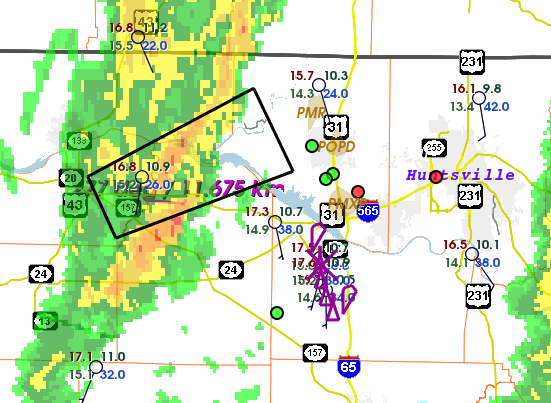
The echoes that grew rapidly at the time of the last update were quite shallow… less than 15,000 ft deep.

Unless conditions become more favorable quite soon, we are likely to call it quits.

Tags: None

IOP2 Update #4 3:30 PM Thur Mar 24

Hours of waiting, but we are seeing echoes develop rapidly in a confluence zone in NW AL down to eastern MS.  Dewpoints have risen to the low-mid 60’s in the vicinity of this zone.  So we are watching this closely as it approaches our larger dual-Doppler lobes.

Tags: None

IOP2 Update #3 1:20 PM Thur Mar 24

We are watching a weak circulation moving through our high-resolution northern Dual-Doppler lobe, associated with a break in the line.  The circulation extends from the surface to the upper parts of these cells.  The cells are producing little lightning.  The best activity with this line has occurred in a small area of locally larger surface-based CAPE of less than one county in size.  Late grab from SASSI:

temp5

Tags: None

IOP2 Update #3 12:22 PM Thur Mar 24

A couple of lines of showers have passed through, and the atmosphere has stayed stable.  However, very recent surface observations indicate that we may be getting close to having surface-based CAPE.  This means that a parcel of air rising from the ground will begin ascending buoyantly fairly close to the ground.  Our soundings show that the shear from 0-500 m above the ground is about 45 kt which should be supportive of low-level rotation.

The next line of storms is just moving into far NW AL.  Part of this line exhibited some broad rotation recently.

It seems that we may be about to have a transition to more interesting convection with the development of small amounts of surface-based CAPE.

Here’s a recent radar and satellite image from the College of DuPage site:

temp4

Tags: None

IOP2 Update #2 9:25 AM Thur Mar 24

It’s fairly quiet here in N AL right now.  Patches of weak showers and rain.  Some of our special soundings show a very sharp stable layer just above 700 mb, and most of these showers are confined below that layer.  A few are poking above, which is a bit hard to explain.

Computer guidance is really jumping around this morning, portraying everything from a broken line of supercells with significant rotation, to a surging QLCS moving rapidly through the area this afternoon.  So we wait and see what the atmosphere has in store.

All systems are up and running… numerous soundings being obtained today.

Here’s the current reflectivity from the ARMOR radar:

temp3

Tags: None

IOP2 Update #1 6:56 AM Thur Mar 24

The second IOP has begun, with teams now enroute to their designated observing sites, and serial soundings in progress from the NOAA/ATDD crew at Cullman.

The Ops Center is staffed with about eight people already, mainly looking at today’s forecast and developing mental scenarios of the expected evolution.  Sounding coordination in progress.

We are looking at several computer guidance products that paint a fairly serious picture for the northern AL research domain.  The latest guidance indicates two lines of supercells with possible tornadoes will move across the domain today.  The first should pass Huntsville around 2 PM, and the second toward sunset.

Today’s plan is to set up two finescale dual-Doppler observing lobes in the Huntsville/Decatur area.  These lobes will be the focus for detailed sounding, profiler, surface, and precipitation physics observations.  Two larger lobes will capture much of the research domain, and will provide secondary areas for detailed observations if it appears the storms will skip the smaller lobes.

temp2

Tags: None

STATUS: 23 Mar 2016

STATUS:  IOP

The IOP will commence at ~4 AM Thur 24 March with sounding and profiling activities, and ~7 AM with mobile Doppler and other deployable instruments.  We anticipate early convection in the morning that is not likely to be severe, but will lead to a very interesting study of rapid atmospheric evolution that could lead to tornadic storms later in the afternoon.  The observations will occur in a ~12 hour window.

HARD DOWN has been declared for Friday 25 – Sunday 27 March.  There will be no daily briefings during this period.

Briefings will resume Monday 28 March.  All participants need to be aware of the possiblity that the next IOP will be declared during the Monday briefing.

Tags: None

STATUS: 22 Mar 2016

STATUS: IOP

The next IOP will commence sometime between midnight and 6 AM on Thur 24 March.  At that time, shear and CAPE are forecast to begin rising rapidly across northern AL, followed by one or two lines of convection during the day.  There is the potential for a tornadic storm.  The expected mode will be QLCS or a broken line, with supercells possible.

The IOP should terminate in the afternoon or evening when convection ends.

A special IOP planning meeting will occur at SWIRLL on the evening of Wed 23 March to design the observing plan for this IOP.

We are watching Sunday 27 March; right now, CAPE appears to be sufficient for tornadic storms, but shear is progged to be too weak to marginal.  Given the need to conserve resources and the prevalence of tornadoes in April in AL, we are likely to wait for stronger systems in April.

Tags: None

STATUS: 21 Mar 2016

STATUS: IOP

We will be conducting an IOP on Thursday, 24 March.  We anticipate fairly strong forcing associated with a mid-level wave, strong shear (850 flow approaching 50 kt), and CAPE in the range of 300-600 J/kg.  The expected structure will be a QLCS or a QLCS with embedded supercell structures.

Observations will possibly commence in the pre-dawn hours of Thursday, and terminate on Thursday afternoon.  CAPE and shear are expected to grow strongly during a 6-h period prior to passage of the convective line.

Details of the observing plan will depend on the expected time of passage of the convective line, and we await two more days of computer guidance to formulate that plan.  The plan will be discussed more at the Tuesday and Wednesday briefings, and in an evening planning session on Wednesday.

PI’s are reminded to keep the instrument status spreadsheet updated!

Tags: None

STATUS: 20 Mar 2016

STATUS: IOP Watch

Most numerical guidance still points to a frontal passage on Thur 24 March through northern AL, with some disagreement about the time of day.  Shear and CAPE should be increasing through Wednesday night and early morning Thur ahead of this event.  Convection is nearly certain owing to strong lift.

At this time, low-level moisture looks like it will be sufficient for perhaps ~300 J/kg CAPE, and this is close to the climatological threshold for QLCS tornadoes in AL.

A final IOP go/no-go decision will be made at the 1 PM briefing tomorrow (Mon 21st).  For those thinking about travel plans, we will want to be observing by the early morning hours of Thur 24 March.  We will have to conjure a plan starting at the Wednesday briefing, and perhaps also later via SASSI chat/GeoWhiteboard.

Tags: None