IOP2 Update #2 9:25 AM Thur Mar 24

It’s fairly quiet here in N AL right now.  Patches of weak showers and rain.  Some of our special soundings show a very sharp stable layer just above 700 mb, and most of these showers are confined below that layer.  A few are poking above, which is a bit hard to explain.

Computer guidance is really jumping around this morning, portraying everything from a broken line of supercells with significant rotation, to a surging QLCS moving rapidly through the area this afternoon.  So we wait and see what the atmosphere has in store.

All systems are up and running… numerous soundings being obtained today.

Here’s the current reflectivity from the ARMOR radar:

temp3

Tags: None

IOP2 Update #1 6:56 AM Thur Mar 24

The second IOP has begun, with teams now enroute to their designated observing sites, and serial soundings in progress from the NOAA/ATDD crew at Cullman.

The Ops Center is staffed with about eight people already, mainly looking at today’s forecast and developing mental scenarios of the expected evolution.  Sounding coordination in progress.

We are looking at several computer guidance products that paint a fairly serious picture for the northern AL research domain.  The latest guidance indicates two lines of supercells with possible tornadoes will move across the domain today.  The first should pass Huntsville around 2 PM, and the second toward sunset.

Today’s plan is to set up two finescale dual-Doppler observing lobes in the Huntsville/Decatur area.  These lobes will be the focus for detailed sounding, profiler, surface, and precipitation physics observations.  Two larger lobes will capture much of the research domain, and will provide secondary areas for detailed observations if it appears the storms will skip the smaller lobes.

temp2

Tags: None

STATUS: 23 Mar 2016

STATUS:  IOP

The IOP will commence at ~4 AM Thur 24 March with sounding and profiling activities, and ~7 AM with mobile Doppler and other deployable instruments.  We anticipate early convection in the morning that is not likely to be severe, but will lead to a very interesting study of rapid atmospheric evolution that could lead to tornadic storms later in the afternoon.  The observations will occur in a ~12 hour window.

HARD DOWN has been declared for Friday 25 – Sunday 27 March.  There will be no daily briefings during this period.

Briefings will resume Monday 28 March.  All participants need to be aware of the possiblity that the next IOP will be declared during the Monday briefing.

Tags: None

STATUS: 22 Mar 2016

STATUS: IOP

The next IOP will commence sometime between midnight and 6 AM on Thur 24 March.  At that time, shear and CAPE are forecast to begin rising rapidly across northern AL, followed by one or two lines of convection during the day.  There is the potential for a tornadic storm.  The expected mode will be QLCS or a broken line, with supercells possible.

The IOP should terminate in the afternoon or evening when convection ends.

A special IOP planning meeting will occur at SWIRLL on the evening of Wed 23 March to design the observing plan for this IOP.

We are watching Sunday 27 March; right now, CAPE appears to be sufficient for tornadic storms, but shear is progged to be too weak to marginal.  Given the need to conserve resources and the prevalence of tornadoes in April in AL, we are likely to wait for stronger systems in April.

Tags: None

STATUS: 21 Mar 2016

STATUS: IOP

We will be conducting an IOP on Thursday, 24 March.  We anticipate fairly strong forcing associated with a mid-level wave, strong shear (850 flow approaching 50 kt), and CAPE in the range of 300-600 J/kg.  The expected structure will be a QLCS or a QLCS with embedded supercell structures.

Observations will possibly commence in the pre-dawn hours of Thursday, and terminate on Thursday afternoon.  CAPE and shear are expected to grow strongly during a 6-h period prior to passage of the convective line.

Details of the observing plan will depend on the expected time of passage of the convective line, and we await two more days of computer guidance to formulate that plan.  The plan will be discussed more at the Tuesday and Wednesday briefings, and in an evening planning session on Wednesday.

PI’s are reminded to keep the instrument status spreadsheet updated!

Tags: None

STATUS: 20 Mar 2016

STATUS: IOP Watch

Most numerical guidance still points to a frontal passage on Thur 24 March through northern AL, with some disagreement about the time of day.  Shear and CAPE should be increasing through Wednesday night and early morning Thur ahead of this event.  Convection is nearly certain owing to strong lift.

At this time, low-level moisture looks like it will be sufficient for perhaps ~300 J/kg CAPE, and this is close to the climatological threshold for QLCS tornadoes in AL.

A final IOP go/no-go decision will be made at the 1 PM briefing tomorrow (Mon 21st).  For those thinking about travel plans, we will want to be observing by the early morning hours of Thur 24 March.  We will have to conjure a plan starting at the Wednesday briefing, and perhaps also later via SASSI chat/GeoWhiteboard.

Tags: None

STATUS: 19 Mar 2016

STATUS: IOP Watch

We continue to watch the evolution of the system that will move through northern AL late next week.  Passage of the conditions most supportive of tornadic storms should occur between Thur (24th) noon and Fri (25th) noon.  There are still big questions about the return of humid air from the Gulf of Mexico, and the degree of instability that will develop associated with the moisture return.  Otherwise, it is more likely that strong shear will develop, sufficient for tornadic storms.  A final IOP decision will be made no later than the Monday (21st) daily briefing.

Tags: None

STATUS: 18 Mar 2016

STATUS: IOP Watch

We continue to watch the wave and cold front that will affect the northern AL region around Thur/Fri of next week (24-25 March).  If current guidance is correct, shear will be sufficient, but CAPE will be marginal.  The latter is because moisture is not returning strongly off of the Gulf of Mexico after the passage of a cold front tomorrow.

If the models trend toward better moisture return, this IOP becomes more likely.  The IOP decision likely will be made on Sunday or Monday (20 or 21 March).

Tags: None

First VORTEX-SE Observations collected

The first Intensive Observing Period (IOP) of VORTEX-SE is completed.

Observations began in the early afternoon on Sunday, 13 March, with a sounding launch by NOAA’s ARL/ATDD from the SWIRLL facility at the University of Alabama in Huntsville (UAH).  UAH is hosting VORTEX-SE, and the Operations Center is at the SWIRLL.

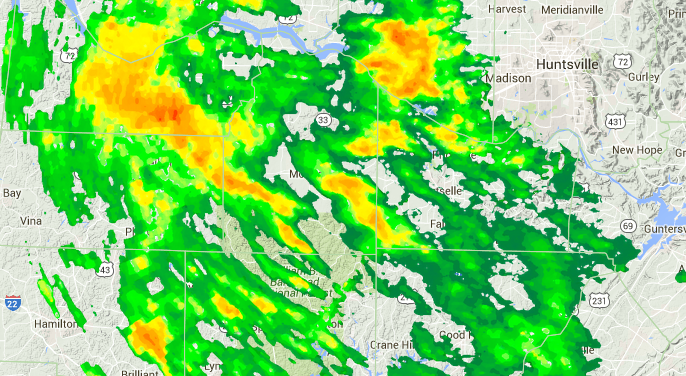
Shortly after the midday briefing and weather discussion, the lead investigators in VORTEX-SE huddled to come up with the science plan for this episode.  The main weather feature of concern was a compact, fast-moving upper low pressure system moving out of southeast Oklahoma, expected to cross Arkansas and the Memphis, TN area during the nighttime and early morning hours.  We were fairly sure a system this intense would be associated with thunderstorms.  Much of the forecast guidance indicated that, in northern Alabama, there would be little or no surface-based CAPE (a measure of the energy available to produce buoyant, rising motion in air that is lifted from the ground feeding a thunderstorm updraft).  This doesn’t mean no storms… thunderstorms can be energized by air that originates somewhere above the ground… but tornadoes are unlikely when the surface-based CAPE is zero.  So our decision was to deploy as far west in northern Alabama as we could, hoping that the storms would still be somewhat energetic and perhaps there would be a little lingering surface-based CAPE before nighttime cooling removed it completely.  Where we can deploy is largely determined by where we can find suitable sites for mobile Doppler radars: because so many crucial processes in tornado formation happen near the ground, this requires a good radar view of the horizon without hills, trees, power lines, buildings, etc. obstructing the view.

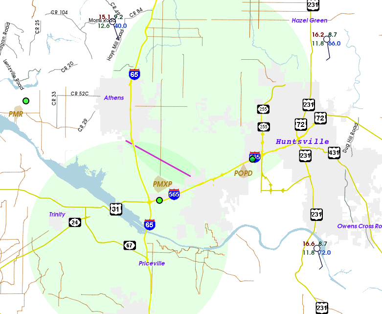
Most of the research teams had found locations for their measurements by evening.  Sounding teams were arrayed along a line from Huntsville toward the west-northwest into northeastern Mississippi.  Mobile Doppler radars were arrayed in a triangle near Florence, AL, and other instruments joined them there, such as deployable disdrometers to measure raindrop sizes and numbers, and deployable “sticknets” to measure the temperature, humidity, pressure, and wind near the ground.

During the night, it became apparent from our soundings and the surface data that in fact the near-ground air had cooled under nearly clear skies, eliminating all surface-based CAPE.  Nevertheless, the band of thunderstorm activity continued to advance east across MS, and into AL around 2 AM.  With these storms, there was only very weak horizontal shear (change in wind from one area to another, about a mile apart, that might be a precursor to vortex formation) on a couple of occasions.  The storms were feeding off of air from well above the ground, and in this case no severe weather was reported at the ground.  By around 5 AM, the storms had weakened to showers and showed signs of departing the area to the north, and our observing operations were ended.

Was the mission a success?  I have some thoughts coming together that I will try to write down in a blog post in the “Perspectives” category soon.  We failed to observe any low-level vortices that could have developed into tornadoes, but I think we were successful in several ways.

First, one of the key aspects of VORTEX-SE is learning how to make observations to answer important tornado questions in the Southeast.  This is far from trivial.  We have no mobility in the traditional sense of storm chasing:  hills, trees, low clouds, sparse winding roads, rapid storm motion, storms at night, lack of deployment sites, and other factors make mobility nearly impossible.  So the challenge becomes how to forecast the probable weather with enough lead time to put together a scientifically useful observing network.  This means anticipating the structure, motion, and intensity of storms at least a few hours before they occur, instead of on the time scales of minutes that we became accustomed to in earlier tornado research programs.  In developing the network, important considerations are Doppler radar placement to allow for overlapping beams (giving us the ability to estimate 3D wind), and focusing the other observing systems within those multiple-radar networks.  In this first IOP, we were able to iron out the many of the wrinkles in deployment strategies, communication, and coordination.

Second, these “null cases” where we fail to observe tornadoes are important.  This is under-appreciated, even among many tornado researchers.  Thinking back across many years of storm chasing in the Plains, one of the toughest forecasts to make is when there is huge CAPE, but the warm, humid low-level air is trapped below a warm, stable layer of air aloft… the so-called “cap”.  We can compute a temperature called the “convective temperature” at which the air near the ground becomes warm enough to remove that stable layer, and convection ensues (it’s not that simple, but in broad terms the concept works pretty well).  So all this available energy can be associated with no deep cumulus clouds, or it can be associated with monster supercells, depending on a few degrees Fahrenheit difference in temperature near the ground.  Forecasting whether that “tipping point” occurs can be a big challenge with big consequences.  A similar situation exists in the Southeast: a few degrees difference in low-level temperature (and similarly, small changes in humidity) can mean the difference between no surface-based CAPE with small chances of vortex development near the ground, or “some” surface-based CAPE and much greater chances of vortex development.  To be clear, surface-based CAPE is just one number that we use to get a sense of low-level conditions; the intensification of a vortex near the ground is too complex to be understood using these simple parameters alone.  But no matter how one characterizes the near-ground conditions, it is likely that subtle differences can change the atmosphere from suppressing low-level vortex formation to favoring it.  In an ideal (lucky) IOP, we would observe a case where part of the domain had just-good-enough air for low-level spinups, and part of the area did not, and then we could compare the resulting weather in those two areas.  In the IOP we just finished, we were successful in sampling conditions that were slightly on the unfavorable side.

In VORTEX-SE we hope to make observations like these 4-5 times during March and April.  I hope we can observe a variety of regimes that have tornado potential during the remainder of our IOPs.

Tags: None

STATUS: 17 Mar 2016

STATUS: IOP Watch

We are now beginning to watch the system that is expected to move through the southern US around Thur/Fri next week (25-26 Mar).  We will try to make a decision regarding an IOP on this system on Sunday (20th), or Monday (21st).

Tags: None