STATUS: 18 March 2018

STATUS:IOP

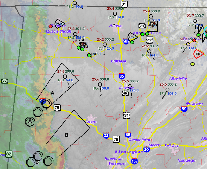
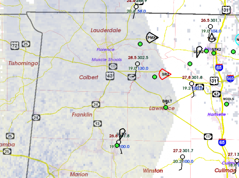
We have moved the U. Oklahoma SMART-Radars to the northern AL subdomain at Huntsville, and all the needed platforms should be available for a mission tomorrow (Mon 19th).

Despite small run-to-run fluctuations, the numerical guidance continues to show the potential for tornadic supercells in the domain tomorrow. Some significant tornadoes may occur. This overall theme has been present in the forecasts since Thursday morning, but that’s no guarantee that it will come about.

I sent a special heads-up email this morning to a group of more than 20 researchers in the social, behavioral, and engineering sciences because many of these folks are engaged in studying how the lead-up to tornado events influences reactions to an actual threat, and many of them need to do research immediately following tornadoes or tornado warnings. We all hope for no suffering, while still being ready to learn how to reduce or prevent the suffering caused by future events.

Right now, we are expecting convection to develop in eastern MS around 2 PM, and sweep east across AL and into GA by sunset. The P-3 aircraft is scheduled to take off at 2 PM on Monday.

I will try to post an update just prior to our observing mission… midday Monday.

Tags: None

STATUS: 16 March 2018

STATUS: IOP today through Monday

VORTEX-SE will be conducting observations over the next several days that are primarily designed to improve our approaches to storm studies in the Southeast.

The brand new University of Oklahoma SMART-Radar has joined the existing SMART-Radar in the Monroe Louisiana area this evening. We have been fairly confident for the past two days that there would not be initiation of significant convection in that region, but we have the radars in place just in case. If a cell(s) formed this evening, we would be able to obtain multiple-Doppler observations teaming up with the University of Louisiana-Monroe S-band research radar. But the atmosphere is gradually stabilizing and quieting down in that area, and research-worthy storms are very unlikely this evening.

Starting tomorrow (Saturday/17 March) our focus will shift up to the northern Alabama subdomain near the University of Alabama-Huntsville (UAH). There, the two OU radars will team up with the UAH ARMOR research radar and the MAX mobile x-band radar, as well as several other important platforms operated by UAH primarily to measure changes in the lower atmosphere at frequent time intervals. The NOAA P-3 hurricane hunter aircraft is also on standby in Huntsville, their base for this spring.

On Saturday and Sunday, strong upper winds will persist across most of the Southeast, and CAPE will gradually be increasing as moisture advances slowly northeast from the western Gulf of Mexico. At just about any time Saturday and Sunday, potentially tornadic (very low probability) storms are possible in the northern Alabama area, so it’s best for us to shift our resources up to that area.

But the main consideration in our decisions today is that the models are suggesting a very potent set up across northern AL on Monday. The forecast looks perilous, and experience suggests that often forecasts of large severe weather probabilities this far in advance do not pan out. But we are watching Monday warily.

Our IOP will likely end Monday night, with a few days of quiet and rest in store after that.

Tags: None

STATUS: 10 March 2018

STATUS: IOP in progress

As of 2 PM CT, the NOAA P-3 aircraft is in the air.

Today’s situation seems to pick up where the last two seasons left off: very difficult to forecast the potential for tornadic storms in the Southeast, even a few hours in advance. For several days, the models had been painting a pretty consistent picture of the highest potential for research-worthy storms across N LA. Last night, the convection-allowing guidance such as the HRRR and the NAM-Nest (NAM-3km) jumped to a consistent idea of very little convection across N LA, but a band of storms with rotating updrafts moving across central AR this evening, and heading SE toward central MS tonight. This pretty much is smack dab in between our two subdomains (near Monroe, LA and Huntsville, AL).

Of course the P-3 can cover a lot of ground quickly, but the challenges of planning those missions is huge. They can only carry a certain amount of fuel, and obviously they have to spend a certain amount of time on the ground between missions. So the P-3 scientists have to decide today what they plan on doing tomorrow. And since there are targetable storms possible tomorrow in southern AL and GA, they opted to go ahead and fly at 2 PM today on an 8 hour mission, and have scheduled a mission for tomorrow as well.

As I write, the interesting storms are forming in eastern OK, and we will watch them closely to see if 1) they develop southeastward into AR early enough for the P-3 to study them, and 2) if they are showing signs of developing down toward the Monroe area where our ground-based radars are waiting.

Tags: None

STATUS: 8 March 2018

Status: GO for Saturday IOP

Teams are enroute, or will soon be, to the Monroe LA subdomain of VORTEX-SE. This is one of two subdomains we will use this year, depending on the forecasted weather.

A narrow mid-tropospheric jet is forecast to be advancing toward Louisiana from the west-northwest on Saturday. To the north of this jet, lift will be strong, likely leading to quite a bit of precipitation and low-level cooling. To the south, the air will be sinking which should enhance the “lid” and possibly limit convection. Between these two regions, there should be a narrow goldilocks zone of sufficient CAPE and strong shear that could support some low-level rotation. Of course, many things can go wrong (and usually do, to the benefit of the general public) with this scenario and any convection may be non-rotating.

We will deploy one mobile C-band “SMART-Radar” from OU to pair with the U. Louisiana-Monroe S-band research radar, and ULM mobile sounding teams. The NOAA P-3 aircraft will likely take off midday Saturday and head toward Louisiana, if this forecast holds up. They will make radar observations of the most interesting storms, and will focus on storms over the ground radar domain near Monroe when storms are present there.

There is a slim chance that there will be tornado potential in the Georgia/N Florida area on Sunday. Although we don’t have a ground subdomain there, the P-3 aircraft may fly a mission to observe storms in that region.

Thereafter, we expect quiet conditions until the following weekend.

One more time with the caveat: forecasting conditions for a field observing program are very different than forecasting for more general purposes. We are generally fine with a “busted forecast”, especially if we are able to obtain data to tell us why we busted. Learning what processes reduce tornado potential are almost as interesting as catching tornadic events. Because tornadoes are rare, we have to observe most everything that comes along with even a little potential. And this spring, our focus is not so much on the physical processes in the atmosphere in the Southeast, but learning how to make much better observations in this difficult region.

Tags: None

Spring 2018 observations begin

This spring, we are taking a breather from the style of experiments we conducted in 2016 and 2017. This is intended to give researchers some time to study data we have already collected, and to use new insights to improve our scientific questions and use of resources in future years.

However, the NOAA P-3 Hurricane Hunter aircraft will be used in VORTEX-SE this spring. This aircraft has a Doppler radar with a pair of antennas in the tail so that we can do analysis of the precipitation and winds in Southeast storms. One antenna looks slightly forward of the aircraft and the other slightly rearward. As the plane flies by a storm, along-beam velocities measured in these two separate “look angles” can be combined to give us the complete velocity at millions of points.

We have a huge challenge in VORTEX-SE owing to the terrain and vegetation to produce the kinds of mobile radar analyses that have been obtained comparatively routinely in the Great Plains. Until we can tackle this problem, we will not be able to do the sorts of detailed storm studies that can tell us how a particular tornado formed, and how the parent storm might have behaved differently than the fairly well-understood Great Plains cousins. So in addition to the NOAA P-3, we will be deploying three-radar networks consisting of University of Oklahoma SMART-Radars (dual-polarization mobile C-band radars) and either the U. Alabama-Huntsville C-band dual-polarization Doppler radar at Huntsville (known as ARMOR), or the U. Louisiana-Monroe S-band dual-polarization Doppler radar at Monroe. We want to know if such deployments of combined surface/airborne Doppler radars can be used to produce higher quality storm airflow analyses than other combinations of radars, and whether/not we can do a better job piecing together the airflow patterns in the crucial near-ground layer that is so important to tornado formation and longevity. Then, using this assessment, we can more effectively plan future observations to address VORTEX-SE science questions.

Tags: None

STATUS: 7 MARCH 2018

STATUS: IOP Watch

We are anticipating a possible IOP on Saturday and Saturday night.

A trough will deepen across the northern High Plains late Friday, causing an acceleration of the flow in the upper atmosphere across OK on Saturday. This trough will consolidate somewhat as it approaches MO/AR, and a surface low will deepen fairly rapidly somewhere in the region centered near Memphis.

The developing southerly flow should bring Gulf moisture back into the Arklatex region Friday night, although the confidence in the “quality” of this moisture is not high. A series of runs of the operational GFS show a subtle decrease with time in the forecasted dewpoints across the region on Saturday, and an associated decrease in CAPE. We expect that drier air will remain in place across GA, and perhaps parts of AL, because the pattern and fast-moving wave will not allow moisture to return to those areas. So any complex of storms that develop in the Arklatex region Saturday will eventually run out of juice as they race east.

Another question (seemingly always a major issue in VORTEX-SE) is the likelihood, timing, and effect of an MCS in the Gulf of Mexico. These systems are probably associated with subtle waves in the jet stream, and those waves may not be well forecast until within 24 hours of passage because prior to that time they are somewhere out over the Pacific.

The current best guess is that storms will form in far east Texas on Saturday, with at least some tornado potential, and roll east across Louisiana in the evening, and perhaps into MS/AL during the night. We expect that our most likely subdomain for combined airborne and surface radar observations will be the U. Louisiana-Monroe subdomain.

Bear in mind when reading these discussions that we are forecasting conditions required for successful research operations. We have a very high tolerance for erroneous forecasts of possible tornadoes; they are a rare phenomenon and it is a lot more painful to miss an observing opportunity than it is to be operating and nothing happens.

A final IOP decision will be made Thursday afternoon, 8 March.

Tags: None

UPDATE 1… 30 April 2017

Two rotating storms within a QLCS are moving toward the domain:

The field teams are seeing a map something like this, with the storms annotated as A and B.  The Purdue and Texas Tech teams (green dots on the NW-SE hiway) are moving into position to collect data on Storm A.  Other teams have been deployed on Sand Mountain in the northeast corner of this map to observe the storms later this afternoon and evening.

Tags: None

STATUS: 30 April 2017

This is the last observing day of the 2017 Spring Campaign.  Our project window extends through May 8, but by the end of today, we will have exhausted most of our project resources.

This may be shaping up to be one of the more interesting days of the project.  An initial band of tornadic storms is racing east through Mississippi early this morning.  It looks like this first line will make it through the domain by midday to early afternoon.  The atmospheric profiles ahead of this line are not going to be particularly favorable for tornadoes in northern AL.  But there is the possibility that this line will leave behind an outflow boundary that could retreat back north through AL toward evening.  When this happens, the low-level shear could become very large, and the thermodynamic profiles may be quite favorable near the ground for tornadoes.

Even with the system 12 h away, it is nearly impossible to forecast the details.  So we’re excited about the potential gain of knowledge to make these events easier to forecast in the future.

Our Texas Tech and Purdue research teams are already heading west toward MS, hoping to sample the cold pool and precipitation produced by this initial line.  Later, they will probably retreat east or southeast ahead of the possible second round of severe convection.  Our radar and profiler teams are headed to the Sand Mountain plateau east of Huntsville to get one more comprehensive data set on the evolution of flow and low-level thermodynamics in complex terrain, ahead of and during severe storm episodes.  The NOAA hurricane hunter aircraft will be departing Huntsville around 2 PM and use their Doppler radar systems to study individual severe storms.  And toward mid-morning we will have about 10 sounding teams across northern AL and MS sampling the atmosphere every hour or two.

I will try to sneak in another blog post or two as this event unfolds.

Tags: None

update 28 April

The storms failed to form so far, and there are no strong indications that they will form.  So we are pulling the more western teams back in toward the area just north of Lake Wheeler, near Decatur, AL.  We will spend the rest of the day observing the features that evolve in the lowest kilometer or so of the atmosphere in response to variations in land use and land cover, including lake/land contrasts.  This information should be important to help folks who work on forecast models to evaluate the performance of those models.


Tags: None

STATUS: 28 Apr 2017

I am blogging from the SWIRLL facility at UA-Huntsville.

We came in this morning for a 10 AM meeting, expecting to design a clear-air boundary layer study to look at land use/land cover variations, and lake breeze effects in the area west of Huntsville.  The model guidance from yesterday generally showed our area too stable for storms.

But (there’s always a BUT in VORTEX-SE)… this morning the HRRR model showed rotating storms developing over our research domain in the early afternoon.  This forecast has persisted for the last 4-5 hours at least, with consistent forecasts of rotating updrafts moving across our western observing area.

So, we adapted by quickly moving one sounding unit and one radar further west in case these storms form.  If we don’t have storm initiation in the next hour or so, we will bring these two units back closer to Huntsville, and do the “clear-air” experiment for the rest of the day.

Our two western-most mobile radars are SR2 and PMXP, and their “dual-Doppler” coverage extends west out across the Florence/Muscle Shoals area.  Dual-Doppler means that the along-beam velocity from each radar can be combined geometrically to compute the actual wind direction and speed at every point seen by the two radars.  The uncertainty in this wind computation is smallest when the two radar beams cross at large angles, and the wind becomes very uncertain as the two beam directions get closer together.

Tomorrow there will probably be no observing in the VORTEX-SE domain.  Sunday continues to look like an active day.  But if we have learned anything this year, it’s that these strong systems have a variety of “failure modes”.  They typically look very promising for severe weather for several days leading up to the event, and then something goes awry and no/few tornadic storms occur.

Tags: None